We use cookies to make your experience better. To comply with the new e-Privacy directive, we need to ask for your consent to set the cookies. Learn more
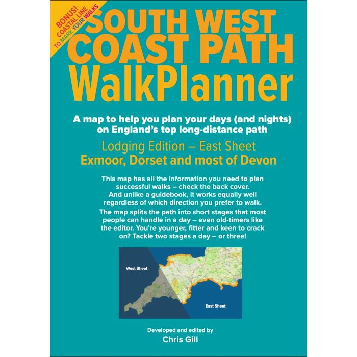
South West Coast Path WalkPlanner
Lodging Edition East Sheet-Exmoor,Dorset and most of Devon
£7.99
In Stock
Usually dispatched within 24 hrs. Free delivery to UK for orders £25 and over
A map to help you plan your days (and nights) on England's top long distance path.
| Cordee Code: | CTO602 |
|---|---|
| Page Size: | 125 x 175 mm |
| No of Pages: | 2 |
| Publisher: | Guide Editors |
| ISBN13: | 9781999770839 |
| Author: | Chris Gill |
| Published Date: | December 2025 |
| Edition: | 1st ed, Dec 2025 |
| Binding: | Sheet Map (folded) |
| Weight: | 80g |
| Product Type: | Book |
Marked on this map are:
37 path stages, all with lodgings (or buses to lodgings) at each end, and practically all walkable in a leisurely day, to suit walkers of limited stamina. To cover the ground more quickly, just do two or three stages together.
For each stage you get:
- distance-to-walk and height-to-climb figures
- a total effort rating based on those figures
- notes on the terrain and the challenges it presents
- warnings of 12 Tricky Bits - parts of the path that some people find unnerving - with pointers to alternative routes
- a coastal line with a white bit to colour in, to record your progress
- 205 lodgings, from hostels to swanky spa hotels, where possible with price ratings and other key information
- 62 useful bus routes categorised by frequency of service
- 40 out-of-town car parks, with National Trust ones flagged
- 76 taxi firms with phone numbers, grouped by locality
- 6 crucial river ferries with seasons, hours, phone numbers
- 13 diversions, from historic houses to nature reserves, where you might want to spend some time along the way
- 0 campsites - campers will get dedicated maps in 2026
-
 Walking The South West Coast PathFrom Minehead to South Haven Point£17.95
CP0308
In StockOut of stock -

-
 Explore the South West Coast PathA Guide for Walkers, Backpackers and Trail Runners£24.99
CWS692
In Stock