We use cookies to make your experience better. To comply with the new e-Privacy directive, we need to ask for your consent to set the cookies. Learn more
Wales Geological Maps
The Wales Geology Maps collection on Cordee.co.uk is an essential resource for geologists, hikers, and nature enthusiasts exploring the geological landscapes of Wales. These detailed maps provide comprehensive information on Wales' geological formations, including rock types, fault lines, and landforms. Whether you're studying the geology of Snowdonia, Brecon Beacons, or the coastal regions, these maps offer valuable insights and guidance for fieldwork and outdoor exploration. Perfect for academic research or geological adventures, these maps help you understand and navigate the unique geological features of Wales.
-
 Abergavenny Solid and drift geology map 1:50 000 scale geology map E232 (England and Wales)£12.00
CGM130
In Stock -
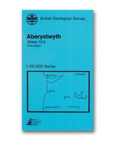 Aberystwyth Solid and drift geology map 1:50 000 scale geology map E163 (England and Wales)£12.00
CGM110
In Stock -
 Aberystwyth Solid geology map 1:50 000 scale geology map E163 (England and Wales)£12.00
CGM109
In Stock -
 Alnwick E6 Solid and Drift geology map 1:50,000 scale geology map E6(England and Wales)£15.00
CGM576
In Stock -
 Alresford Solid and drift geology map 1:50 000 scale geology map E300 (England and Wales)£12.00
CGM406
In Stock -
-
Ambleside Solid geology map 1:50 000 scale geology map E38 (England and Wales)£12.00
CGM283
In Stock -
Ammanford Solid and drift geology map 1:50 000 scale geology map E230 (England and Wales)£12.00
CGM127
In Stock -
Ammanford Solid with drift geology map 1:50 000 scale geology map E230 (England and Wales)£12.00
CGM126
In Stock -
 Andover Bedrock and Superficial Map 1:50 000 scale geology map E283 (England and Wales)£12.00
CGM144
In Stock


Shop By
Filters