We use cookies to make your experience better. To comply with the new e-Privacy directive, we need to ask for your consent to set the cookies. Learn more
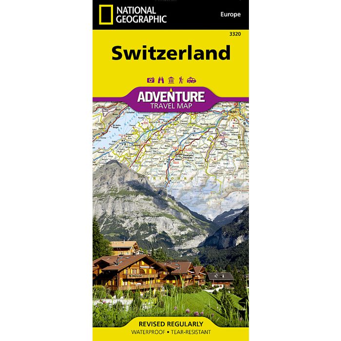
Switzerland Map
Adventure Maps
£14.95
In Stock
Usually dispatched within 24 hrs. Free delivery to UK for orders £25 and over
| Cordee Code: | NG0071 |
|---|---|
| Page Size: | 110 x 230 mm |
| Publisher: | National Geographic Maps |
| ISBN13: | 9781566956390 |
| Binding: | Sheet Map (folded) |
| Weight: | 100g |
| Product Type: | Map |
| Countries: | Switzerland |
Waterproof Tear-Resistant Travel MapNational Geographic's Switzerland Adventure Map provides global travelers with the perfect combination of detail and perspective in a highly functional travel tool. Cities and towns are clearly indicated and easy to find in the user-friendly index. A road network complete with distances and designations for roads, motorways, expressways, and secondary routes will help you find the route that's right for you. Specialty content to include hundreds of diverse and unique recreational, ecological, cultural, and historical destinations, make this map invaluable to travelers hoping to experience all the attractions the country has to offer. Botanical gardens, campsites, archeological sites, castles, caves, scenic viewpoints, and golf courses are among the many points of interest noted.The eastern half of the country from the city of Luzern east is shown on the front side of the print map, from the border with Germany to the north, Austria to the east, and Italy to the south. The reverse side covers Luzern to the western border with France. The locations of airports, airfields, railroads, border crossings, and car ferries take the guesswork out of travel around the country. Selected filling stations, hotels, restaurants, and snackbars are also marked for travelers seeking additional resources.Every Adventure Map is printed on durable synthetic paper, making them waterproof, tear-resistant and tough capable of withstanding the rigors of international travel.