We use cookies to make your experience better. To comply with the new e-Privacy directive, we need to ask for your consent to set the cookies. Learn more

Pembrokeshire Coast Path Map
1:25,000 Ordnance Survey maps for the Wales Coast Path
£9.99
In Stock
Usually dispatched within 24 hrs. Free delivery to UK for orders £25 and over
| Cordee Code: | CWW410 |
|---|---|
| Page Size: | 107 x 215 mm |
| No of Pages: | 48 |
| Publisher: | Northern Eye Books |
| ISBN13: | 9781908632623 |
| Scale: | 1:25,000 |
| Author: | Northern Eye |
| Published Date: | September 2023 |
| Edition: | Sept 2023 |
| Binding: | Paperback (flapped) |
| Illustrations: | Full colour throughout |
| Weight: | 112g |
| Geoarea: | Snowdonia |
| Product Type: | Book |
Continuous OS mapping covering the Wales Coast Path between Cardigan and Amroth. Contains extracts from large scale 1:25,000 Explorer maps 35 and 36.
- Large scale OS mapping for the complete coast of Pembrokeshire in a handy atlas format. (Also covers the entire Pembrokeshire Coastal Path)
- Highlighted official route of the Wales Coast Path
- On-map symbols showing amenities at main towns and villages
- Introduction with attractive photo mosaic
- Additional useful information
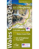
One of seven handy, lightweight, pocket size map books covering the whole of the 870-mile/1400 kilometre Wales Coast Path - from Chester to Chepstow. Each map book matches one of the seven sections covered by the Official Guidebooks.
.
Sections include: 1: North Wales Coast, 2: Isle of Anglesey, 3: Llyn Peninsula, 4: Snowdonia & Ceredigion Coast, 5: Pembrokeshire, 6: Carmarthen Bay & Gower, and 7: South Wales Coast.
- Large scale OS mapping for the complete coast of Pembrokeshire in a handy atlas format. (Also covers the entire Pembrokeshire Coastal Path)
- Highlighted official route of the Wales Coast Path
- On-map symbols showing amenities at main towns and villages
- Introduction with attractive photo mosaic
- Additional useful information
One of seven handy, lightweight, pocket size map books covering the whole of the 870-mile/1400 kilometre Wales Coast Path - from Chester to Chepstow. Each map book matches one of the seven sections covered by the Official Guidebooks.
.
Sections include: 1: North Wales Coast, 2: Isle of Anglesey, 3: Llyn Peninsula, 4: Snowdonia & Ceredigion Coast, 5: Pembrokeshire, 6: Carmarthen Bay & Gower, and 7: South Wales Coast.
-
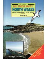 Best Coastal Walks in North WalesDee to Anglesey & Llyn Peninsular - Kittiwake£5.95
CWW294
In Stock -
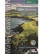 Llyn Peninsula: Wales Coast Path Official GuideBangor to Portmadog£12.99
CWW313
Temp Out Of StockOut of stock
Other titles of interest:
-
 Llyn Peninsula Coast Path Map WCP1:25 000 scale OS mapping for the Llyn Peninsula£9.99
CWW388
In Stock