We use cookies to make your experience better. To comply with the new e-Privacy directive, we need to ask for your consent to set the cookies. Learn more
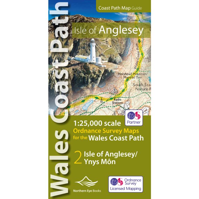
Isle of Anglesey Coast Path Map WCP
1:25 000 scale OS mapping for the Isle of Anglesey WCP
£9.99
In Stock
Usually dispatched within 24 hrs. Free delivery to UK for orders £25 and over
| Cordee Code: | CWW387 |
|---|---|
| Page Size: | 107 x 215 mm |
| No of Pages: | 48 |
| Publisher: | Northern Eye Books |
| ISBN13: | 9781908632593 |
| Scale: | 1:25 000 |
| Published Date: | November 2019 |
| Edition: | 1st, November 2019 |
| Binding: | Paperback |
| Illustrations: | Full colour maps |
| Weight: | 90g |
| Product Type: | Guide Books |
Enhanced, large scale (1: 25,000) Ordnance Survey mapping in a handy atlas format with all the mapping you need to walk a complete circuit of the Anglesey section of the Wales Coast Path. Continuous OS mapping covering the complete circuit from Menai Bridge. Contains coastal extracts from large scale Explorer maps 262 and 263.
- Large scale Ordnance Survey mapping for the complete circuit of the Isle of Anglesey in a handy atlas format.
- Highlighted official route of the Wales Coast Path/ Anglesey Coastal Path.
- On-map symbols showing amenities at main towns and villages.
- Introduction with attractive photo mosaic.
- Additional useful information
-

-
-
-
 Dog Friendly Pub Walks: Anglesey Lleyn Peninsula15 great pubs that welcome dogs£9.99
CWW390
In Stock