We use cookies to make your experience better. To comply with the new e-Privacy directive, we need to ask for your consent to set the cookies. Learn more
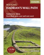
Hadrians Wall Path 2nd Edition
Rucksack Readers
£16.99
In Stock
Usually dispatched within 24 hrs. Free delivery to UK for orders £25 and over
Hadrian's Wall Path runs for 85 miles (137 km) between Bowness-on-Solway and Wallsend (Newcastle) along the line of the Roman Wall completed in AD122 under the Emperor Hadrian.
| Cordee Code: | RR0044 |
|---|---|
| Page Size: | 130 x 220 mm |
| No of Pages: | 96 |
| Publisher: | Rucksack Readers |
| ISBN13: | 9781913817312 |
| Author: | Jacquetta Megarry & Gordon Simm |
| Published Date: | September 2025 |
| Edition: | 2nd ed, Sept 2025 |
| Binding: | Spiral/wirobound |
| Illustrations: | Full colour photos and maps |
| Weight: | 220g |
| Product Type: | Guide Books |
| Countries: | Scotland |

This National Trail crosses northern England from Irish Sea to North Sea and offers many chances to look at the forts, milecastles and interpretation centres within this UNESCO World Heritage Site.
The route is clearly waymarked and well supported with friendly pubs, cafes and accommodation. This second edition features new mapping at 1:50,000 with mileage markers running in both directions. It includes many route updates and fresh photos. Almost uniquely, it gives equal priority and space to directions for west-to-east as for east-to-west. Although it has 50% more pages than the previous edition, it is compact and lightweight.
This guidebook contains all you need to plan and enjoy Hadrian's Wall Path:
-Detailed route descriptions step-by-step, both west-to-east and east-to-west
-Custom mapping at 1:50,000 on 43 pages
-History and anatomy of the Wall
-Forts, milecastles and visitor centres
-Geology, wildlife and heritage
-Accommodation and transport
-Full colour throughout, with over 100 photos
-Robust, rucksack-friendly and on rainproof paper.