We use cookies to make your experience better. To comply with the new e-Privacy directive, we need to ask for your consent to set the cookies. Learn more
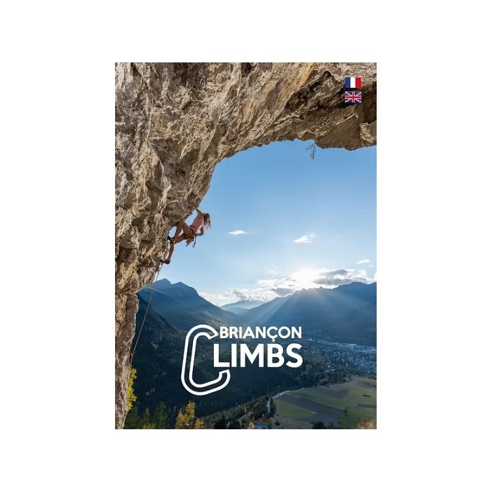
Briancon Climbs: 2026 Edition
Escalade Haut Val Durance, Queyras - Hautes Alpes
£44.95
In Stock
Usually dispatched within 24 hrs. Free delivery to UK for orders £25 and over
This is a comprehensive guidebook covering the rock climbing in the Durance Valley around the towns of Briancon, Ailefroide, La Vallouise, L'Argentiere-la-bessee and Guillestre. The Durance Valley is located in the Hautes Alps near Grenoble that is sometimes referred to as the Southern Alps or the Ecrins.
The guidebook describes 11 separate rock climbing areas and 100 major crags ranging from single pitch and multi-pitch sports routes to long classic alpine ascents up to 600m long. The 11 main areas are Vallee de la Claree et Vallee Etroite, Vallee de la Guisane, Briancon, Vallouise, L'Argentiere - La Bessee, La Roche de Rame, Freissinieres, Valle de Tramouillon - Saint Crepin, Guillestre, Queyras, and Embrunais.
All the routes are illustrated on either full colour photo-topos or topo diagrams with French grades used throughout. At the start of each crag there is a location map along with access information, and GPS coordinates for the parking area. Symbols are then used to show the grade range, orientation, best time of the year to climb, maximum height of the routes, style of the climbing, type of rock, and how long the walk-in is from the car.
Published in March 2026 (revised 14th Edition) this guidebook is in French and English text througho
| Cordee Code: | CCE838 |
|---|---|
| Page Size: | 150 x 210 mm |
| No of Pages: | 406 |
| Publisher: | M Yann Rolland |
| ISBN13: | 9782958158415 |
| Author: | Rolland family |
| Published Date: | March 2026 |
| Edition: | 14th: March 2026 |
| Binding: | Paperback |
| Illustrations: | photo and drawn topos plus action photos |
| Weight: | 580g |
| Geoarea: | Alps Western (france, Switzerland, And Italy) |
| Product Type: | Guide Books |
| Countries: | France |
This is a comprehensive guidebook covering the rock climbing in the Durance Valley around the towns of Briancon, Ailefroide, La Vallouise, L'Argentiere-la-bessee and Guillestre. The Durance Valley is located in the Hautes Alps near Grenoble that is sometimes referred to as the Southern Alps or the Ecrins.
The guidebook describes 11 separate rock climbing areas and 100 major crags ranging from single pitch and multi-pitch sports routes to long classic alpine ascents up to 600m long. The 11 main areas are Vallee de la Claree et Vallee Etroite, Vallee de la Guisane, Briancon, Vallouise, L'Argentiere - La Bessee, La Roche de Rame, Freissinieres, Valle de Tramouillon - Saint Crepin, Guillestre, Queyras, and Embrunais.
All the routes are illustrated on either full colour photo-topos or topo diagrams with French grades used throughout. At the start of each crag there is a location map along with access information, and GPS coordinates for the parking area. Symbols are then used to show the grade range, orientation, best time of the year to climb, maximum height of the routes, style of the climbing, type of rock, and how long the walk-in is from the car.
Published in March 2026 (revised 14th Edition) this guidebook is in French and English text throughout.