We use cookies to make your experience better. To comply with the new e-Privacy directive, we need to ask for your consent to set the cookies. Learn more
Yorkshire Three Peaks Challenge Series Map Pack
3 x 1:25,000 scale MiniMaps
£14.99
Temp Out Of Stock
Mini Maps are pocket sized, waterproof walking maps that use 1:25,000 scale Ordnance Survey mapping. This pack includes 3 x 1:25,000 scale maps printed on A3 sized paper.They cover just the Yorkshire Three Peaks - Pen-y-ghent, Whernside, Ingleborough, with route guide cards for each peak.
| Cordee Code: | CMO003 |
|---|---|
| Page Size: | 140 x 170 mm |
| Publisher: | My Mini Map |
| ISBN13: | 9780992918415 |
| Scale: | 1:25,000 |
| Published Date: | August 2014 |
| Edition: | 1st ed, 2014 |
| Binding: | Other |
| Illustrations: | 3 x 1:25k OS maps |
| Weight: | 110g |
| Product Type: | Map |
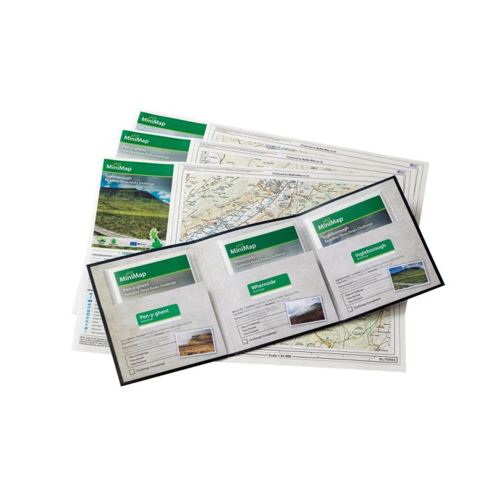
These maps will guide you to the peaks of The Yorkshire Three Peaks Challenge taking in the summits of Pen-y-ghent, Whernside & Ingleborough - usually in that order. To truly meet the Challenge you are supposed to reach the summit of all three in under 12 hours.
For those who may prefer to enjoy the journey and linger a little longer to really make the most of some stunning views these MiniMaps will help to make the route finding and referencing a whole lot easier.
Mini Maps are pocket sized, waterproof walking maps that use 1:25,000 scale Ordnance Survey mapping. No Origami skills required, Minimaps are easy to unfold, view, and when you're sure you're on the right path, to tuck away in a small, easily accessed place.
This pack includes 3 x 1:25,000 scale maps printed on A3 sized paper.They cover just the Yorkshire Three Peaks - Whernside, Ingleborough and Pen-y-ghent, with route guide cards for each peak.
-

-
-
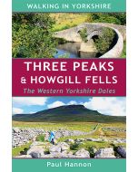 Three Peaks and Howgill Fells Western Yorkshire DalesWalking in Yorkshire Series£4.99
CWP710
In Stock
Other titles of interest:
-
 National Three Peaks Challenge Series Map Pack3 x 1:25,000 scale MiniMaps£14.99
CMO002
Temp Out Of Stock