We use cookies to make your experience better. To comply with the new e-Privacy directive, we need to ask for your consent to set the cookies. Learn more
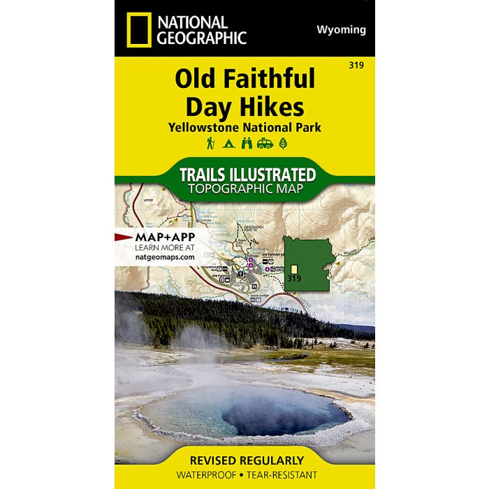
Yellowstone National Park: Old Faithful Day Hikes: Map
Trails Illustrated Maps
£11.95
In Stock
Usually dispatched within 24 hrs. Free delivery to UK for orders £25 and over
| Cordee Code: | NG0261 |
|---|---|
| Page Size: | 100 x 190 mm |
| Publisher: | National Geographic Maps |
| ISBN13: | 9781566956659 |
| Binding: | Sheet Map (folded) |
| Weight: | 94g |
| Product Type: | Map |
| Countries: | United States of America |
Waterproof Tear-Resistant Topographic MapNational Geographic's Trails Illustrated map of the Old Faithful area of Yellowstone National Park is designed to meet the needs of visitors with unmatched detail of the upper and midway geyser sections of the national park. Expertly researched and created in partnership with local land management agencies, this map features key points of interest including the Old Faithful geyser area, Midway Geyser Basin, Old Faithful, and Fountain Paint Pots. A list of recommend day hikes includes distances and difficulties. The Continental Divide Trail passes through this map.With many miles of mapped trails and marked Bear Management Zones the Old Faithful Day Hikes map can guide you off the beaten path and back again. The clearly marked trails include mileages between intersections. The map base includes contour lines and elevations for summits, passes and many lakes. Some of the many recreation features include: visitor centers, campgrounds, trailheads, hydrothermal features and interpretive trails.Every Trails Illustrated map is printed on "Backcountry Tough" waterproof, tear-resistant paper. A full UTM grid is printed on the map to aid with GPS navigation.Other features found on this map include: Yellowstone National Park.
-
-

-
 Yellowstone National Park Old Faithful Day Hikes, PackTrails Illustrated Maps£21.95
NG0298
In Stock