We use cookies to make your experience better. To comply with the new e-Privacy directive, we need to ask for your consent to set the cookies. Learn more
World Executive Map Poster Size and Tubed
Reference Maps
£19.95
Temp Out Of Stock
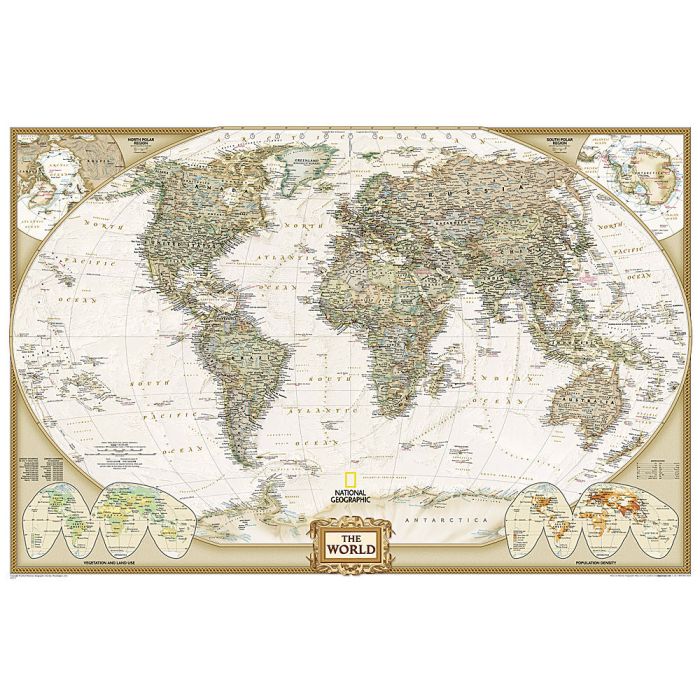
Expertly researched and designed, National Geographic's World Wall Map is the authoritative map of the world by which other reference maps are measured.
| Cordee Code: | NG0816 |
|---|---|
| Page Size: | 900 x 600 mm |
| No of Pages: | 1 |
| Publisher: | National Geographic Wall Maps |
| ISBN13: | 9781597752084 |
| Weight: | 620g |
| Product Type: | Others |
Dimensions: H61cm x W91cm
Product Features:
-Antique-style "executive" color palette
-Background shows mountain ranges and valleys in subtle shaded relief with mountain ranges labeled
-Major water bodies including rivers, lakes, glaciers, oceans, seas, gulfs, bays, straits, and bathymetry
-Clearly defined international boundaries, cities, islands, airports, and physical features
-Thousands of place names carefully and artfully placed to maintain legibility in heavily populated areas
-Up-to-date international boundaries and territorial control reflect de facto status on the ground
-Meticulously researched using multiple authoritative sources including the U.N., U.S. Board on Geographic Names, and policies of individual governments.
-Accurate place names use a combination of conventional English names, official national names, and standard transliterations for non-Latin alphabets.
-Drawn in Winkel Tripel projection with distortions minimized unlike other World maps (e.g. Greenland is shown the same size as Argentina, not South America)
-Corner inset maps feature vegetation, land use, population density, and north and south polar regions
The 36" x 24" poster size supports easy and affordable framing and mounting, and takes less wall space than standard wall maps.The map is packaged in a two inch diameter tube with a label showing a thumbnail of the map with dimensions and other pertinent information.