We use cookies to make your experience better. To comply with the new e-Privacy directive, we need to ask for your consent to set the cookies. Learn more
World Executive Map Enlarged and Tubed
Reference Maps
£39.95
In Stock
Usually dispatched within 24 hrs. Free delivery to UK for orders £25 and over
| Cordee Code: | NG0812 |
|---|---|
| Page Size: | 1850 x 1220 mm |
| No of Pages: | 1 |
| Publisher: | National Geographic Maps |
| ISBN13: | 9780792293170 |
| Binding: | Oversized Tube |
| Weight: | 500g |
| Product Type: | Others |
Dimensions: H122cm x W185cm
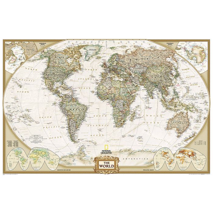
Expertly researched and designed, National Geographic's World Wall Map is the authoritative map of the world by which other reference maps are measured.
Product Features:
Antique-style "executive" color palette
Background shows mountain ranges and valleys in subtle shaded relief with mountain ranges labeled
Major water bodies including rivers, lakes, glaciers, oceans, seas, gulfs, bays, straits, and bathymetry
Clearly defined international boundaries, cities, islands, airports, and physical features
Thousands of place names carefully and artfully placed to maintain legibility in heavily populated areas
Up-to-date international boundaries and territorial control reflect de facto status on the ground
Meticulously researched using multiple authoritative sources including the U.N., U.S. Board on Geographic Names, and policies of individual governments.
Accurate place names use a combination of conventional English names, official national names, and standard transliterations for non-Latin alphabets.
Drawn in Winkel Tripel projection with distortions minimized unlike other World maps (e.g. Greenland is shown the same size as Argentina, not South America)
Corner inset maps feature vegetation, land use, population density, and north and south polar regions
Enlarged maps provide an immersive experience in any home or office environment. The exceptional cartography is even easier to appreciate at the larger size. The map is packaged in a two inch diameter tube with a label showing a thumbnail of the map with dimensions and other pertinent information.
Please note that these maps come rolled in a tube and are oversized. As such they attract an extra carriage charge of ?10 (non-trade customers only).