We use cookies to make your experience better. To comply with the new e-Privacy directive, we need to ask for your consent to set the cookies. Learn more
Title Not Available
£12.90
In Stock
Usually dispatched within 24 hrs. Free delivery to UK for orders £25 and over
| Cordee Code: | FB0848 |
|---|---|
| Page Size: | 100 x 205 mm |
| Publisher: | Freytag & Berndt |
| ISBN13: | 9783850847179 |
| Published Date: | December 2018 |
| Binding: | Sheet Map (folded) |
| Weight: | 50g |
| Product Type: | Map |
| Countries: | Austria |
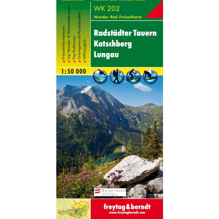
The WK 202 "Radst?dter Tauern - Katschberg - Lungau 1:50,000" is revised regularly and contains updated information on hiking trails, cycle and mountain bike routes, huts, natural monuments, cultural sights and leisure facilities. The enclosed information booklet contains a selection of the best hiking trails, cycle paths and mountain bike routes as well as a brief description of the individual communities and their leisure activities. (Language: German) Leisure information, hiking and long-distance hiking trails, mountain bike and cycling tours, register of places with postcodes, GPS-compatible, via ferrata, ski route, cross-country route, Nordic walking route; Region: Murtal, Radst?dter Tauern, Katschberg, Nockberge, Lungau, Ponau, Salzburg, Maltatal, Carinthia; Special themed hiking trails: Rupertiweg, Leonhardsweg, Arnoweg, Salzburg Almenweg, book path, Styrian state circular hiking trail, Malteiner water features nature trail, Landwier lakes; Special cycle and mountain bike tours: Murradweg, Ennsradweg, Rieding Route, Preber Route, Hinterlahn Route, Three Lakes Tour. Area maps: WK 191, WK 201, WK 203, WK 211, WK 221, WK 222, WK 225. Thanks to the detailed digital cartography and the precise scales, freytag & berndt hiking maps are ideal companions for hiking, mountaineering and ski tours.