We use cookies to make your experience better. To comply with the new e-Privacy directive, we need to ask for your consent to set the cookies. Learn more
Wind River Range North Map Pinedale, Dubois
Trails Illustrated Maps
£14.95
In Stock
Usually dispatched within 24 hrs. Free delivery to UK for orders £25 and over
| Cordee Code: | NG0521 |
|---|---|
| Page Size: | 110 x 230 mm |
| Publisher: | National Geographic Maps |
| ISBN13: | 9781566958264 |
| Binding: | Sheet Map (folded) |
| Weight: | 94g |
| Product Type: | Map |
| Countries: | United States of America |
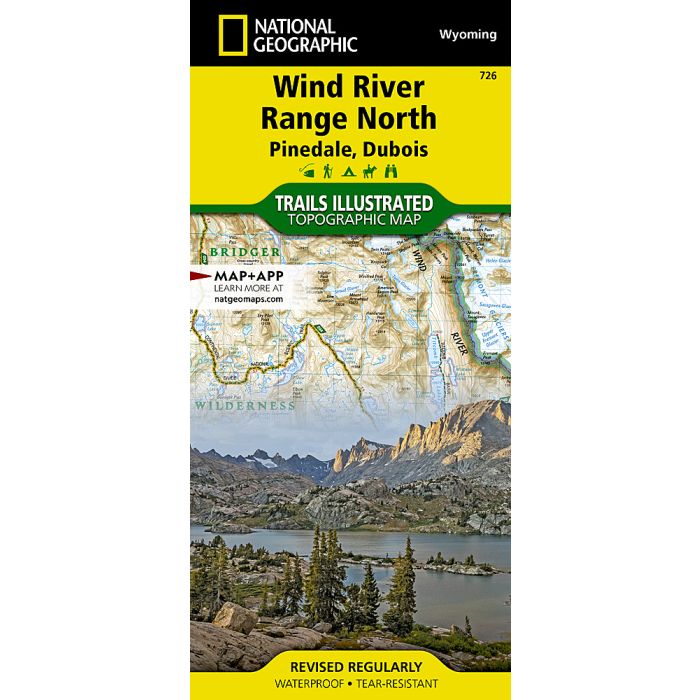
Waterproof Tear-Resistant Topographic MapThe Wind River Range of northwest Wyoming encompasses an area of more than 3,500 square miles. Locally known as just "The Winds", the range contains a unique combination of jagged granite rock, alpine forest, open meadows, over 1,300 named lakes, and the largest glacier in the American Rockies. Recreation opportunities are distributed across the landscape with hiking, camping, fishing, and snowmobiling to list just a few.The map is centered on the northern section of the Wind River Range. The Fitzpatrick Wilderness and a large section Bridger Wilderness are clearly shown with the Continental Divide running through the middle of the map. The glaciers and countless lakes make this map a must-have for visitors entering from Pinedale or Dubois. The Continental Divide Trail transects this area on its way from Mexico to Canada. The map also includes Gannett Peak, the highest point in Wyoming.The Wyoming State Department of Fish and Game provides data on known fish presence for the thousands of lakes that appear on this map. Each lake with fish is highlighted to help anglers find just the right spot. Each section of trail includes mileage information to help with planning and steep sections of trail are marked so hikers will know what to expect on their trip.Every Trails Illustrated map is printed on "Backcountry Tough" waterproof, tear-resistant paper. A full UTM grid is printed on the map to aid with GPS navigation.Other features found on this map include: Boulder Lake, Bridger Wilderness, Bridger-Teton National Forest, Dinwoody Peak, Fitzpatrick Wilderness, Fremont Lake, Fremont Peak, Gannett Peak, Green River Lakes, Half Moon Lake, Highline Trail, New Fork Lakes, Shoshone National Forest, Squaretop Mountain, Trapper's Point, Union Pass, Whiskey Mountain, White Pine Ski Area, Willow Lake, Wind River, Wolverine Peak.