We use cookies to make your experience better. To comply with the new e-Privacy directive, we need to ask for your consent to set the cookies. Learn more
Washington Map Laminated
Reference Maps
£49.99
In Stock
Usually dispatched within 24 hrs. Free delivery to UK for orders £25 and over
| Cordee Code: | NG0793 |
|---|---|
| Page Size: | 1030 x 770 mm |
| No of Pages: | 1 |
| Publisher: | National Geographic Maps |
| ISBN13: | 9781597752503 |
| Weight: | 500g |
| Product Type: | Others |
Dimensions: H77cm x W103cm
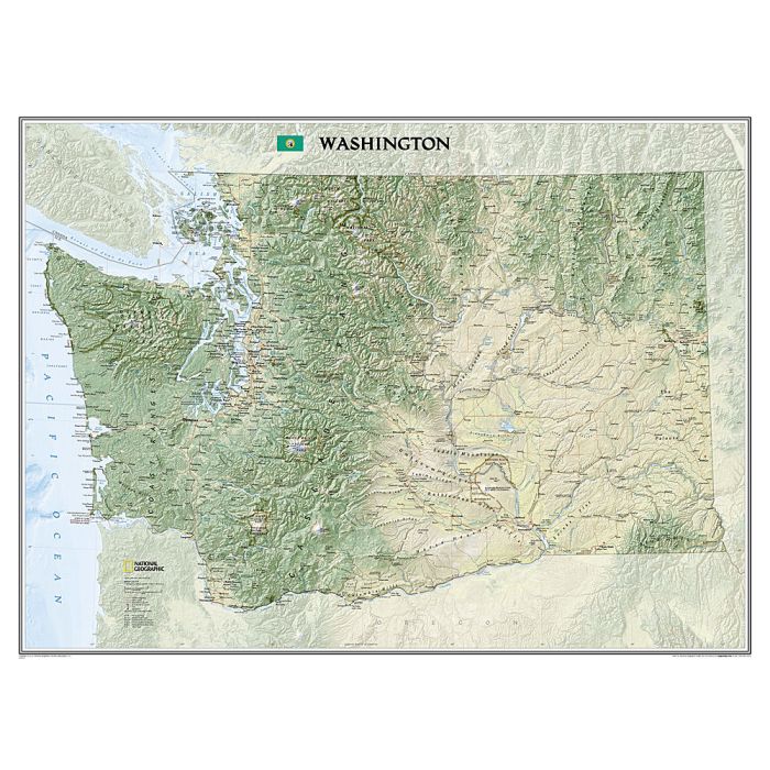
Explore the forested islands of Puget Sound, the snow-capped Cascades, and the agricultural basins fed by the Columbia and Snake rivers with National Geographic?s wall map of Washington. Part of the growing series of State Wall Maps, this map offers a dramatic visualization of the Evergreen State?s physical geography. Stunning shaded relief and vibrant colorization depicts mountain ranges, forests, valleys, and other physical topography.
In addition to the geographical features such as mountain ranges, prominent peaks, islands, major lakes, rivers, and reservoirs, this map includes the location of cities, towns, airports, national and state parks, and military bases. The Pacific Crest Trail, a long-distance hiking and equestrian trail to runs through the entire state from the border with Canada into Oregon, is shown as well.
The map is encapsulated in heavy-duty 1.6 mil laminate which makes the paper much more durable and resistant to the swelling and shrinking caused by changes in humidity. Laminated maps can be framed without the need for glass, so the frames can be much lighter and less expensive.