We use cookies to make your experience better. To comply with the new e-Privacy directive, we need to ask for your consent to set the cookies. Learn more
Walking Offas Dyke Path
1:25,000 Route Map Booklet
£12.95
In Stock
Usually dispatched within 24 hrs. Free delivery to UK for orders £25 and over
| Cordee Code: | CP0087 |
|---|---|
| Page Size: | 116 x 172 mm |
| No of Pages: | 96 |
| Publisher: | Cicerone Press |
| ISBN13: | 9781852848941 |
| Published Date: | March 2016 |
| Edition: | 1st ed, March 2016 |
| Binding: | Paperback (encapsulated) |
| Illustrations: | OS Mapping |
| Weight: | 120g |
| Product Type: | Map |
| Countries: | United Kingdom |
All the mapping you need to complete the Offa's Dyke Path National Trail, the longest linear earthwork in Britain, running 177 miles along the English-Welsh border between Sedbury (near Chepstow) and Prestatyn on the north Wales Coast, linking the Severn Estuary and the Irish Sea, contouring above the Wye and Dee, visiting hillforts and Norman castles and exploring the hidden heritage of the Marches.
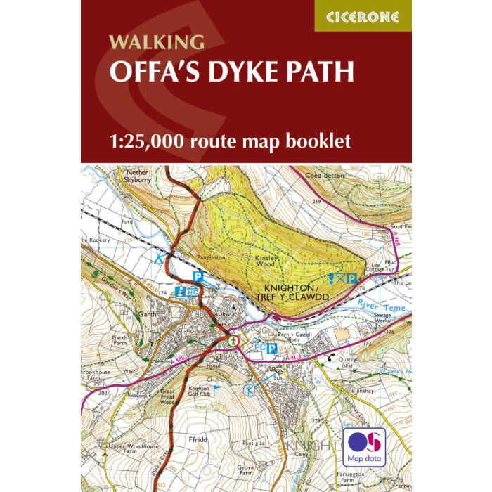
This booklet of Ordnance Survey 1:25,000 Explorer maps has been designed for convenient use on the trail. It shows the full and up-to-date line of the Offa's Dyke Path, along with the relevant extract from the OS Explorer map legend. It is conveniently sized for slipping into a jacket pocket or top of a rucksack and comes in a clear PVC sleeve.
The walk is astonishingly varied, taking in the lower Wye gorge, the Severn and the Dee rift valley, the pastures and woodlands of the border country, the remote moorland of the Black Mountains and the Clwydian range, and the dramatic limestone escarpments of Eglwyseg mountain. What makes it even more special is over 60 miles walking alongside the Saxon earthwork of Offa's Dyke, the path sometimes on the Dyke and sometimes alongside. A companion guidebook - Offa's Dyke Path - describes the full route in both directions with lots of other practical and historical information, and is supplied in a PVC sleeve together with a map booklet.