We use cookies to make your experience better. To comply with the new e-Privacy directive, we need to ask for your consent to set the cookies. Learn more
Walking in Arolla and Zinal
The Val d'Herens and Val d'Annivers in the Swiss Valais
£17.95
Not Yet Published
This title has not yet been released. You may pre-order now and we will deliver it to you when it arrives.
Contact [email protected]
Contact [email protected]
Expected: 15th June 2024
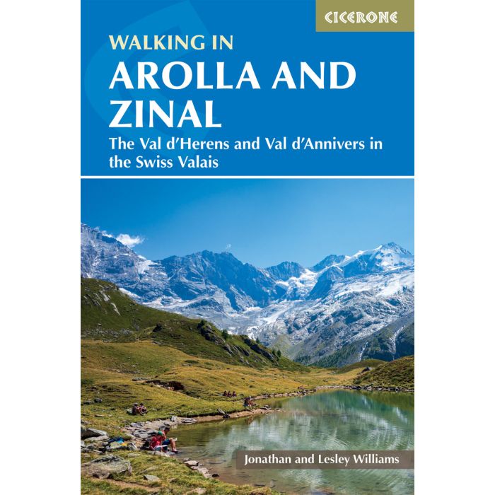
A guidebook to 35 scenic mountain walks in Val d'Herens & Val d'Anniviers, west of Zermatt. Most of the walks are of medium difficulty using well maintained mountain paths and are perfect for walking from mid-June to September.
| Cordee Code: | CP0413 |
|---|---|
| Page Size: | 116 x 172 mm |
| No of Pages: | 192 |
| Publisher: | Cicerone Press |
| ISBN13: | 9781786310965 |
| Author: | Jonathan and Lesley Williams |
| Published Date: | June 2024 |
| Edition: | 1st Edition, June 2024 |
| Binding: | Paperback (flapped) |
| Illustrations: | LAM with flaps |
| Product Type: | Guide Books |
| Countries: | Switzerland |
A guidebook to 35 scenic mountain walks in Val d'Herens & Val d'Anniviers, west of Zermatt. Most of the walks are of medium difficulty using well maintained mountain paths and are perfect for walking from mid-June to September.
Walks range from 10-22km and can be enjoyed in 4-10 hours
Highlights include Dent Blanche, Weisshorn, Ober Gabelhorn, Pigne d'Arolla, Lac des Dix, Lac de Moiry, Pas de Ch?vres, Ferp?cle valley, Lac Bleu, Grand Dixance barrage
Key centres include Arolla, Zinal, Evol?ne, Les Haud?res and Grimentz
1:50,000 mapping is included for each route
GPX files available to download
Detailed information on planning, transport and amenities
-
 Trekking in the Silvretta and Ratikon AlpsShort Treks and Hut to Hut Day Routes£16.95
CP0001
In Stock -
 Walking in the Valais Switzerland120 Walking Routes and Treks£17.95
CP0003
Temp Out Of StockOut of stock -
-
 Walking in the Engadine SwitzerlandBernina, Engadine valley and Swiss National Park£16.95
CP0256
Temp Out Of Stock -

-
