We use cookies to make your experience better. To comply with the new e-Privacy directive, we need to ask for your consent to set the cookies. Read our privacy and security policy

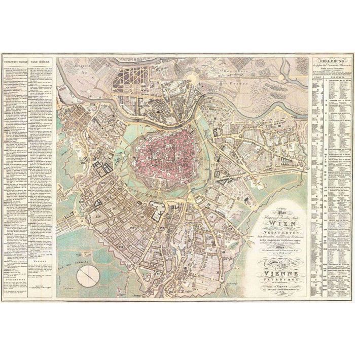
Vienna and the suburbs 1824, Historical map 1:6000, rolled
£19.99
In Stock
Usually dispatched within 24 hrs. Free delivery to UK for orders £25 and over
| Cordee Code: | FB0566 |
|---|---|
| Page Size: | 1090 x 770 mm |
| Publisher: | Freytag & Berndt |
| ISBN13: | 9783707918519 |
| Published Date: | January 2020 |
| Binding: | Oversized Tube |
| Weight: | 300g |
| Product Type: | Map |
| Countries: | Austria |
Latest plan of the main and residence city of Vienna and its suburbs according to the latest numbering of the houses together with details of the embellishments With the highest approval according to the original plan Published in Vienna by Artaria & Comp. At Kohlmarkt No. 1151 With explanation of the streets and numbers of the houses in the city and the suburbs Vienna 1824
The facsimile of a historical city map of Vienna from the year 1824 shows the city center and all suburbs. Scale approx. 1:6,000 posters, plano in a roll, format: 109 x 77 cm.
The facsimile of a historical city map of Vienna from the year 1824 shows the city center and all suburbs. Scale approx. 1:6,000 posters, plano in a roll, format: 109 x 77 cm.