We use cookies to make your experience better. To comply with the new e-Privacy directive, we need to ask for your consent to set the cookies. Learn more
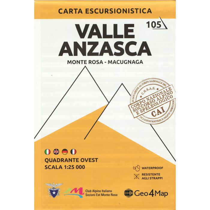
Valle Anzasca west Hiking Map 5 1:25,000
Monte Rosa - Macugnaga
£12.99
In Stock
Usually dispatched within 24 hrs. Free delivery to UK for orders £25 and over
| Cordee Code: | CMI030 |
|---|---|
| Page Size: | 130 x 190 mm |
| Publisher: | Geo4map |
| ISBN13: | 9788899606084 |
| Published Date: | January 2021 |
| Edition: | 2021 |
| Binding: | Sheet Map (folded) |
| Weight: | 100g |
| Product Type: | Map |
| Countries: | Italy |
1:25,000 hiking map covering the west end of the Valle Anzasca, centred on Macugnaga, including Monte Rosa, Corno Rosso and Carcoforo.
Published in association with the CAI, the Italian Alpine Club, who are responsible for the hiking trails. Trails are marked on the map. The key information and more detailed information on the rear of the sheet are in Italian, German and English.
Published in association with the CAI, the Italian Alpine Club, who are responsible for the hiking trails. Trails are marked on the map. The key information and more detailed information on the rear of the sheet are in Italian, German and English.