We use cookies to make your experience better. To comply with the new e-Privacy directive, we need to ask for your consent to set the cookies. Learn more
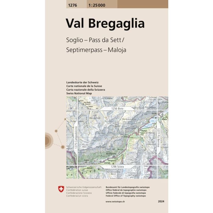
Val Bregaglia 1276
1:25 000
£12.99
In Stock
Usually dispatched within 24 hrs. Free delivery to UK for orders £25 and over
Map No. 1276, Val Bregaglia, in the topographic survey of Switzerland at 1:25,000 from Bundesamt fur Landestopographie (swisstopo), covering the whole country on 247 small format sheets, with special larger maps published for popular regions including some titles now available in hiking versions.
| Cordee Code: | CMZ085 |
|---|---|
| Page Size: | 130 x 190 mm |
| Publisher: | Swisstopo |
| ISBN13: | 9783302012766 |
| Language: | English |
| Published Date: | March 2005 |
| Binding: | Sheet Map (folded) |
| Weight: | 50g |
| Product Type: | Map |
| Countries: | Switzerland |
Map No. 1276, Val Bregaglia, in the topographic survey of Switzerland at 1:25,000 from Bundesamt fur Landestopographie (swisstopo), covering the whole country on 247 small format sheets, with special larger maps published for popular regions including some titles now available in hiking versions.
Highly regarded for their superb use of graphic relief and hill shading, the maps give an almost 3-D picture of Switzerland's mountainous terrain. Contours are at 10 m intervals, with 20m intervals in the mountainous areas. All the maps have a 1-km grid for Swiss national coordinates (datum CH 1903).
Highly regarded for their superb use of graphic relief and hill shading, the maps give an almost 3-D picture of Switzerland's mountainous terrain. Contours are at 10 m intervals, with 20m intervals in the mountainous areas. All the maps have a 1-km grid for Swiss national coordinates (datum CH 1903).