We use cookies to make your experience better. To comply with the new e-Privacy directive, we need to ask for your consent to set the cookies. Learn more
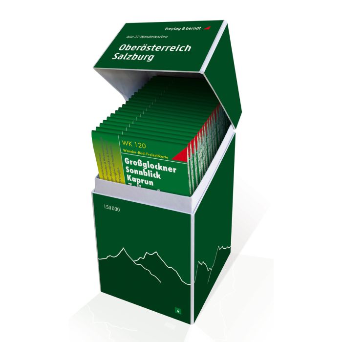
Upper Austria Salzburg, Walking map Set 1:50000
£149.90
Temp Out Of Stock
| Cordee Code: | FB0902 |
|---|---|
| Page Size: | 120 x 215 mm |
| Publisher: | Freytag & Berndt |
| ISBN13: | 9783707919042 |
| Published Date: | September 2020 |
| Binding: | Sheet Map (folded) |
| Product Type: | Map |
| Countries: | Austria |
This unique hiking map box contains a set with all 22 hiking maps for Tyrol, East Tyrol and Vorarlberg on a scale of 1:50,000! It is ideal for frequent hikers who want to explore every bit of nature on their tours!
Thanks to the detailed digital cartography and the precise scales, freytag & berndt hiking maps are ideal companions for hiking, mountaineering, cycling and ski tours. They are of course also GPS compatible.
The hiking and cycling maps provide detailed information about the various hiking and cycling routes in the area shown. This allows you to plan your tours ideally and find out about sights and vantage points along the route.
Scale 1:50 000
hiking trails
via ferratas
Bike paths, mountain bike
Ski routes, cross-country ski trails
Tourist information
Latest edition included
Contents of the Tirol - Osttirol - Vorarlberg hiking map box
WK 120 Grossglockner
WK 121 Grossvenediger
WK 123 Matrei
WK 151 Zillertal
WK 152 Mayrhofen
WK 181 Kals
WK 182 Lienz Dolomites
WW 223 Carnic Alps
WK 241 Innsbruck
WK 251 Oetztal
WK 254 Landeck
WK 301 Kufstein
WK 321 Achensee
WK 322 Wetterstein
WC 351 Lechtal Alps
WK 352 Ehrwald
WK 364 Bregenzerwald
WK 374 Montafon
WK 375 Great Walser Valley