We use cookies to make your experience better. To comply with the new e-Privacy directive, we need to ask for your consent to set the cookies. Learn more
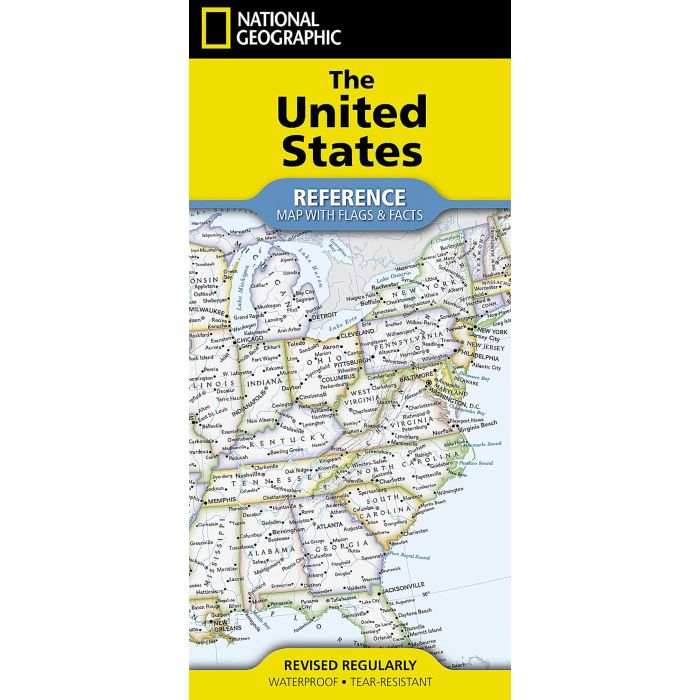
United States Reference Map Folded
with flags and facts
£14.95
In Stock
Usually dispatched within 24 hrs. Free delivery to UK for orders £25 and over
| Cordee Code: | NG0874 |
|---|---|
| Page Size: | 940 x 640 mm |
| No of Pages: | 1 |
| Publisher: | National Geographic Maps |
| ISBN13: | 9781566958097 |
| Published Date: | August 2024 |
| Edition: | August 2024 |
| Binding: | Sheet Map (folded) |
| Weight: | 50g |
| Product Type: | Map |
| Countries: | United States of America |
Waterproof Tear-Resistant Reference Map
Expertly researched and designed, National Geographic's United States Flags & Facts Map is the authoritative map of the United States by which other reference maps are measured. The map side includeds a political map showing countries, cities and other landmarks and a physical map shows the landforms such as mountain ranges and rivers.
Clearly defined boundaries, major cities, and physical features
Hundreds of place names carefully placed to maintain legibility in heavily populated areas
Includes the United States and adjacent regions within Canada and Mexico
Detailed physical map of the United States with mountain ranges, plains, lakes, and rivers
Flags and facts with detailed information about cultural and physcial attributes of each state
Printed in the U.S.A. on extremely durable, waterproof, and tear-resistant material
This Reference Map is printed on durable synthetic paper, making it waterproof, tear-resistant and tough - capable of withstanding the rigors of any kind of use in the home or classroom.