We use cookies to make your experience better. To comply with the new e-Privacy directive, we need to ask for your consent to set the cookies. Learn more
United States Executive Map Laminated
Reference Maps
£29.95
In Stock
Usually dispatched within 24 hrs. Free delivery to UK for orders £25 and over
| Cordee Code: | NG0783 |
|---|---|
| Page Size: | 110 x 770 mm |
| No of Pages: | 1 |
| Publisher: | National Geographic Maps |
| ISBN13: | 9780792233787 |
| Weight: | 500g |
| Product Type: | Others |
| Countries: | United States of America |
Dimensions: H77cm x W110cm
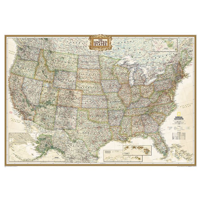
Expertly researched and designed, National Geographic's United States wall map is the standard by which other reference maps of the U.S. are measured.
Product Features:
Antique-style "executive" color palette
All 50 states with insets for Hawaiian Islands and Alaska plus inset showing relative size of Alaska
Clearly defined state and country boundaries, cities, islands, national parks, and physical features
Thousands of place names carefully and artfully placed to maintain legibility in heavily populated areas
Background shows mountain ranges and valleys in subtle shaded relief with mountain ranges labeled
Major water bodies including rivers, lakes, gulfs, bays, straits, and ocean bathymetry
Transportation routes including interstate highways, major state routes, airports, waterways, canals, and ferries
The map is encapsulated in heavy-duty 1.6 mil laminate which makes the paper much more durable and resistant to the swelling and shrinking caused by changes in humidity. Laminated maps can be framed without the need for glass, so the frames can be much lighter and less expensive.