We use cookies to make your experience better. To comply with the new e-Privacy directive, we need to ask for your consent to set the cookies. Learn more
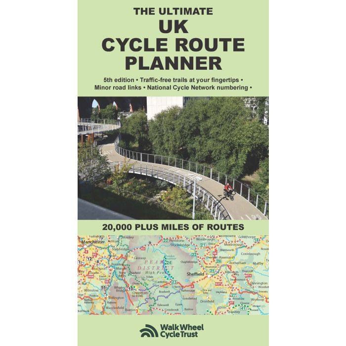
Ultimate UK cycle route planner map
20,000 plus miles of leisure routes, 5th edition
£9.95
In Stock
Usually dispatched within 24 hrs. Free delivery to UK for orders £25 and over
| Cordee Code: | CCY398 |
|---|---|
| Page Size: | 120 x 240 mm |
| No of Pages: | 2 |
| Publisher: | Excellent Books |
| ISBN13: | 9781901464436 |
| Published Date: | November 2025 |
| Edition: | 5th, Nov 2025 |
| Binding: | Sheet Map (folded) |
| Illustrations: | Coplour mapping |
| Weight: | 130g |
| Product Type: | Map |
| Countries: | United Kingdom |
Fully updated and revised 5th edition for 2025. Published by Richard Peace Cycling in collaboration with Walk Wheel Cycle Trust (formerly Sustrans). One of the best selling UK cycle publications, giving an overview of all the main signed UK cycle routes (and also major unsigned ones) - the only publication that has all these together on one single map. Clear design means it is easy to identify the many different kinds of cycle route, from canal towpaths to newer bikepacking and long-distance off-road trails such as the Wolf Way and the Marcher Castles Way.
National Cycle Network route numbers are clearly shown, corresponding with route signage on the ground. Other routes include regional routes such as county cycle ways and those National Trails on which bikes are allowed such as the Pennine Bridleway and the Ridgeway. Many hundreds of miles of minor road routes are also shown and links to signed cross-channel routes such as the Avenue Verte (London-Paris) are shown so that long distance route planning is also made easy.
A bespoke key makes the map easy to understand at a glance. The UK's rail network and its myriad of stations is detailed, showing where and how cyclists can combine bike and train to get access to the country's best cycling. As the scale of the map makes it suitable for planning rather than navigation, full details are given of where you can get larger scale maps of popular rides, such as the C2C, the Devon Coast to Coast and the Way of the Roses.
-
 Ultimate Scottish C2C GuideCoast to Coast Across Scotland by Bike: Annan - Forth Bridge£11.95
CTB016
In Stock -