We use cookies to make your experience better. To comply with the new e-Privacy directive, we need to ask for your consent to set the cookies. Learn more

Trekking Map: Icelands Laugavegur and Fimmvorduhals Trail
1:40 000
£16.99
In Stock
Usually dispatched within 24 hrs. Free delivery to UK for orders £25 and over
| Cordee Code: | CMW781 |
|---|---|
| Page Size: | 116 x 243 mm |
| No of Pages: | 1 |
| Publisher: | Knife Edge Outdoor |
| ISBN13: | 9781912933501 |
| Scale: | 1:40 000 |
| Author: | Andrew McCluggage |
| Published Date: | March 2023 |
| Edition: | 1st, May 2023 |
| Binding: | Waterproof Map (folded) |
| Illustrations: | Full colour photos and 1:40 000 mapping |
| Weight: | 30g |
| Product Type: | Map |
| Countries: | Iceland |
Waterproof sheet map for Iceland's Laugavegur Trail (& Fimmvorduhals Trail): 1:40,000. Includes free GPX downloads for the trails.
The definitive map to Iceland's two best trails: larger scale and more detail than any other map. Made specifically for the treks by Knife Edge Outdoor Guidebooks.
- Waterproof
- Free GPX downloads
- Tough
- Lightweight
- All huts/campsites are marked
- Information on distances, times and altitude gain/loss between huts/campsites
- Hot springs and fumaroles are marked
- Unfolded 486 x 696mm.
The Laugavegur Trail is one of the world's most beautiful and aspirational treks. It leads you into the heart of Iceland's unique ice-capped, volcanic terrain. Experience spectacular and unusual landscapes, the likes of which you will not find anywhere else on the planet. Impressive volcanic peaks are a constant companion and steam gushes from the ground. This is Iceland at its best and it will be an adventure that you will never forget.
Other titles of interest:

-
-
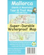 Mallorca North and Mountains Tour and Trail 1:40,000Super-durable POLYMER Map£10.99
CMM214
Temp Out Of StockOut of stock