We use cookies to make your experience better. To comply with the new e-Privacy directive, we need to ask for your consent to set the cookies. Learn more
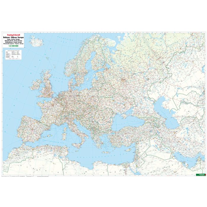
Trains and Ferries European, Railway map 1:55m rolled in a
£19.90
In Stock
Usually dispatched within 24 hrs. Free delivery to UK for orders £25 and over
| Cordee Code: | FB0395 |
|---|---|
| Page Size: | 1240 x 900 mm |
| Publisher: | Freytag & Berndt |
| ISBN13: | 9783707917185 |
| Published Date: | May 2017 |
| Binding: | Oversized Tube |
| Weight: | 500g |
| Product Type: | Map |
The freytag & berndt railway map of Europe stretches from the North Cape down to the Red Sea and from Marrakech to Tashkent! It was developed for railway enthusiasts, train spotters and interrailers and shows not only the railway lines but also high-speed routes and ferry connections. The back of the map shows the main international train connections with journey times between the capital cities. Details: railway routes, ferries, European journey times, location index; plano in Rolle: Rolled map in plastic roll.