We use cookies to make your experience better. To comply with the new e-Privacy directive, we need to ask for your consent to set the cookies. Learn more
Titanic 2 sided Map Tubed
Reference Maps
£24.95
In Stock
Usually dispatched within 24 hrs. Free delivery to UK for orders £25 and over
| Cordee Code: | NG0768 |
|---|---|
| Page Size: | 990 x 660 mm |
| No of Pages: | 1 |
| Publisher: | National Geographic Maps |
| ISBN13: | 9781597755078 |
| Binding: | Other |
| Weight: | 500g |
| Product Type: | Others |
Dimensions: H66cm x W99cm
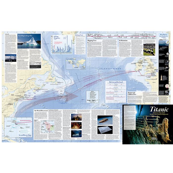
This double-sided, full-colour infographic depicts the details of Titanic's route, shipping lanes before and after the disaster, the journey of the fateful iceberg, charts and statistics from post-disaster hearings, inset map of ice and rescue ships, deep-ocean diagrams of the search process, Titanic points of interest, color-coded deck plans and cutaway view, passengers' profiles, ship size comparisons, the story in art and culture, and plans for the wreck's future.
This double-sided, full-colour infographic depicts the details of Titanic's route, shipping lanes before and after the disaster, the journey of the fateful iceberg, charts and statistics from post-disaster hearings, inset map of ice and rescue ships, deep-ocean diagrams of the search process, Titanic points of interest, color-coded deck plans and cutaway view, passengers' profiles, ship size comparisons, the story in art and culture, and plans for the wreck's future.