We use cookies to make your experience better. To comply with the new e-Privacy directive, we need to ask for your consent to set the cookies. Learn more
The United States for Kids Map tubed
£19.95
In Stock
Usually dispatched within 24 hrs. Free delivery to UK for orders £25 and over
| Cordee Code: | NG0910 |
|---|---|
| Page Size: | 910 x 610 mm |
| No of Pages: | 1 |
| Publisher: | National Geographic Maps |
| ISBN13: | 9781566959414 |
| Binding: | Other |
| Weight: | 500g |
| Product Type: | Others |
Dimensions: H61cm x W91cm
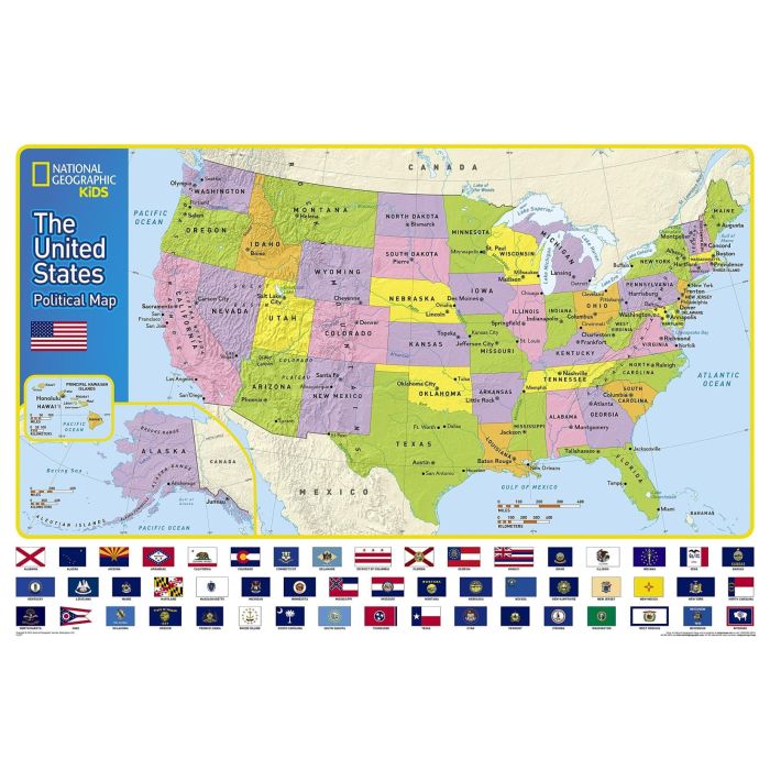
Expertly researched and designed, National Geographic's The United States for Kids wall map is an enticing and engaging United States map perfect for classroom, home or library. Recommended by geography educators for ages 7 - 12, this map features an optimized map design for readability and easy, intuitive learning. All 50 states and the District of Columbia are shown with their official, colorful flags, The flags are arranged in alphabetical order for ease-of-use. Expertly researched, The United States for Kids map is an essential reference tool for today's well informed student of geography.
Expertly researched and designed, National Geographic's The United States for Kids wall map is an enticing and engaging United States map perfect for classroom, home or library. Recommended by geography educators for ages 7 - 12, this map features an optimized map design for readability and easy, intuitive learning. All 50 states and the District of Columbia are shown with their official, colorful flags, The flags are arranged in alphabetical order for ease-of-use. Expertly researched, The United States for Kids map is an essential reference tool for today's well informed student of geography.