We use cookies to make your experience better. To comply with the new e-Privacy directive, we need to ask for your consent to set the cookies. Learn more
The Dynamic Earth Plate Tectonics Map Tubed
Reference Maps
£19.95
Temp Out Of Stock
| Cordee Code: | NG0754 |
|---|---|
| Page Size: | 910 x 610 mm |
| No of Pages: | 1 |
| Publisher: | National Geographic Maps |
| ISBN13: | 9781597754552 |
| Weight: | 350g |
| Product Type: | Others |
Dimensions: H61cm x W91cm
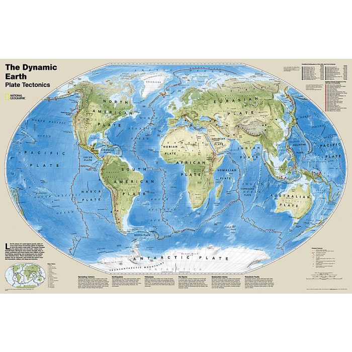
The Dynamic Earth map illustrates plate tectonics and features stunning bathymetry and naturally colored relief, as well as volcano and earthquake data through 2011.
Like pieces of a giant jigsaw puzzle, tectonic plates fit together to form the earth's outer shell. The interaction of these plates causes earthquakes and volcanoes and shapes the earth's crust into mountains, valleys and deep-sea trenches. The Dynamic Earth map illustrates 17 major tectonic plates and highlights diffuse plate boundaries, convergent boundaries, spreading boundaries, fault zones, hot spots, notable earthquakes and volcanic eruptions of the 20th and 21st centuries, earthquakes with a magnitude of greater than 6.5 during the 20th and early 21st centuries, and notable volcanic eruptions during the past 10,000 years.
The map is packaged in a two inch diameter tube with a label showing a thumbnail of the map with dimensions and other pertinent information.