We use cookies to make your experience better. To comply with the new e-Privacy directive, we need to ask for your consent to set the cookies. Learn more
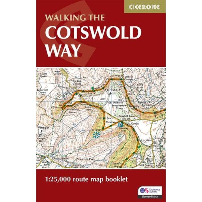
The Cotswold Way Map Booklet
OS Route Mapping
£9.95
In Stock
Usually dispatched within 24 hrs. Free delivery to UK for orders £25 and over
A guidebook to walking the Cotswold Way National Trail between Chipping Camden and Bath
| Cordee Code: | CP0426 |
|---|---|
| Page Size: | 106 x 166 mm |
| No of Pages: | 48 |
| Publisher: | Cicerone Press |
| ISBN13: | 9781786312112 |
| Scale: | 1: 25,000 |
| Author: | Kev Reynolds |
| Published Date: | February 2024 |
| Edition: | 2nd Ed, Feb 2024 |
| Binding: | Sheet Map (folded) |
| Illustrations: | Colour OS mapping |
| Weight: | 60g |
| Geoarea: | Cotswolds |
| Product Type: | Guide Books |
| Countries: | United Kingdom |
A guidebook to walking the Cotswold Way National Trail between Chipping Camden and Bath. Covering 163km (102 miles) across the Cotswolds National Landscape this straightforward hike takes 2 weeks to walk.
The route is presented in 14 stages ranging from 7-17km (4-11 miles) in length. The route is described north to south and an abbreviated route description is also given for those walking the route south to north.
Contains step-by-step description of the route alongside 1:100,000 OS maps reproduced at 1:75,000 for better clarity
Includes a separate map booklet containing OS 1:25,000 mapping and route line
GPX files available to download
The book features a facilities planner that highlights information about facilities and public transport along the route
Full accommodation listings are included
-
-
 Cycling in the CotswoldsHalf and full-day routes and a 200km tour of the Cotswolds£12.95
JBH013
In Stock