We use cookies to make your experience better. To comply with the new e-Privacy directive, we need to ask for your consent to set the cookies. Learn more
The Americas Classic Map Laminated
Reference Maps
£24.95
In Stock
Usually dispatched within 24 hrs. Free delivery to UK for orders £25 and over
| Cordee Code: | NG0749 |
|---|---|
| Page Size: | 590 x 910 mm |
| No of Pages: | 1 |
| Publisher: | National Geographic Maps |
| ISBN13: | 9780792250210 |
| Weight: | 400g |
| Product Type: | Others |
Dimensions: H93cm x W60cm
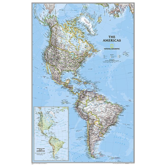
National Geographic's Classic style political wall map of The Americas features a bright colour palette with blue oceans and the continents- terrain detailed in stunning shaded relief that has been a hallmark of National Geographic wall maps for over 75 years. A physical map of The Americas is provided as an inset. This map includes thousands of place names, accurate political boundaries, archeological sites, and major infrastructure networks such as roads, canals, ferry routes, railroads, and airports. Coastal bathymetry is shown with depth curves and soundings, and symbolism for water features and other land forms provides greater detail of the nature of the geography.
The map is encapsulated in heavy-duty 1.6 mil laminate which makes the paper much more durable and resistant to the swelling and shrinking caused by changes in humidity. Laminated maps can be framed without the need for glass, so the frames can be much lighter and less expensive.