We use cookies to make your experience better. To comply with the new e-Privacy directive, we need to ask for your consent to set the cookies. Learn more
Spain and Portugal Classic Map Tubed
Reference Maps
£24.95
Temp Out Of Stock
| Cordee Code: | NG0746 |
|---|---|
| Page Size: | 830 x 550 mm |
| No of Pages: | 1 |
| Publisher: | National Geographic Maps |
| ISBN13: | 9780792249870 |
| Weight: | 620g |
| Product Type: | Others |
Dimensions: H56cm x W84cm
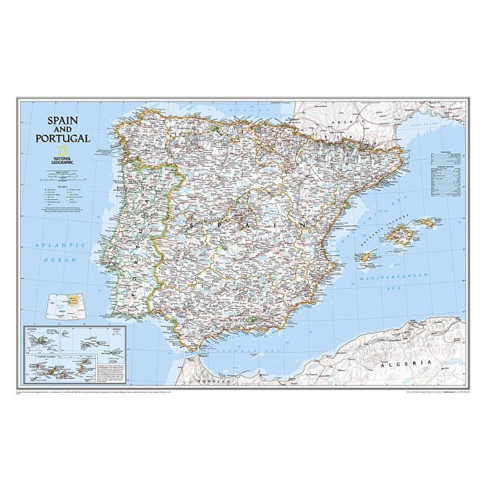
The signature Classic style wall map of Spain and Portugal features a bright color palette with blue oceans and the country's terrain detailed in stunning shaded relief that has been a hallmark of National Geographic wall maps for over 75 years. The map includes thousands of place names, accurate boundaries, national parks, and major infrastructure networks such as roads, highways, airports, ferry routes, and railroads. Coastal bathymetry is shown with depth curves and soundings. Spain's Balearic Islands in the Mediterranean are included. Inset maps provide detail of the Madeira Islands, Azores, and Canary Islands, as well as their location in relation to Spain and Portugal.
The map is packaged in a two inch diameter tube with a label showing a thumbnail of the map with dimensions and other pertinent information.