We use cookies to make your experience better. To comply with the new e-Privacy directive, we need to ask for your consent to set the cookies. Learn more
South Africa Classic Map Tubed
Reference Maps
£16.95
In Stock
Usually dispatched within 24 hrs. Free delivery to UK for orders £25 and over
| Cordee Code: | NG0737 |
|---|---|
| Page Size: | 770 x 600 mm |
| No of Pages: | 1 |
| Publisher: | National Geographic Maps |
| ISBN13: | 9781597755887 |
| Weight: | 620g |
| Product Type: | Others |
Dimensions: H60cm x W77cm
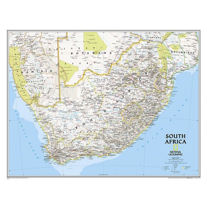
Expertly researched and designed, National Geographic's wall map of South Africa features the country's nine provinces along with the bordering countries of Namibia, Botswana, Zimbabwe, Mozambique, Swaziland, and Lesotho. Also included are southern Africa's premier wildlife venues - its national parks and reserves.
Many local language place-names are used reflecting the region's rich cultural diversity. Physical geography details include shaded relief and cartographic patterns used to depict sand, salt pans, and swamps. This map also features a detailed transportation network including highways, roads, passenger railroads, and major airports.
The signature Classic style map uses a bright, easy to read color palette featuring blue oceans and stunning shaded relief that has been featured on National Geographic wall maps for over 75 years.
The map is packaged in a two inch diameter tube with a label showing a thumbnail of the map with dimensions and other pertinent information.