We use cookies to make your experience better. To comply with the new e-Privacy directive, we need to ask for your consent to set the cookies. Learn more
Shipwrecks of the Outer Banks Map Tubed
Reference Maps
£20.99
In Stock
Usually dispatched within 24 hrs. Free delivery to UK for orders £25 and over
| Cordee Code: | NG0735 |
|---|---|
| Page Size: | 710 x 910 mm |
| No of Pages: | 1 |
| Publisher: | National Geographic Maps |
| ISBN13: | 9781597754996 |
| Weight: | 500g |
| Product Type: | Others |
Dimensions: H91cm x W71cm
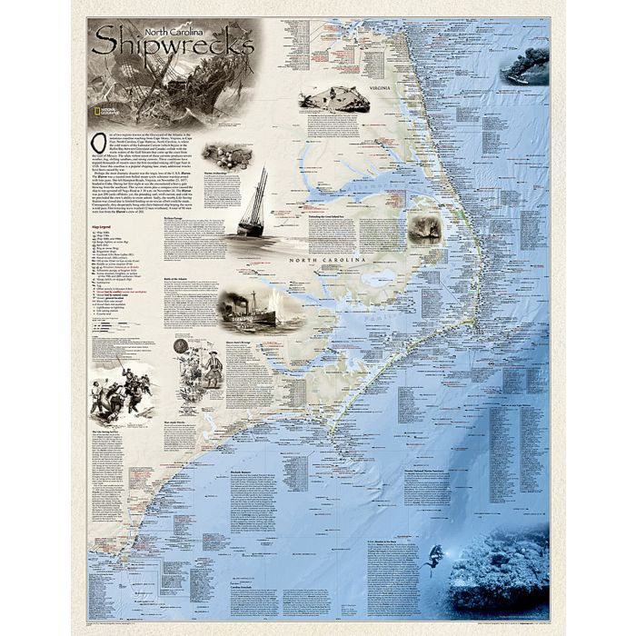
Shipwrecks of the Outer Bank illustrates more than 1,550 shipwrecks of the Atlantic Coast from Cape Henry, Virginia to Cape Fear, North Carolina. Each wreck site is symbolized to define the class, type and name of vessel accompanied by the date of sinking. Icons also indicate whether a ship was lost due to conflict or natural causes.
Locations of lifesaving stations and lighthouses, along with navigational beacons are also marked. Bathymetric and coastal features are clearly labeled. Captions and drawings highlight unique historical events.
The map is packaged in a two inch diameter tube with a label showing a thumbnail of the map with dimensions and other pertinent information.