We use cookies to make your experience better. To comply with the new e-Privacy directive, we need to ask for your consent to set the cookies. Read our privacy and security policy

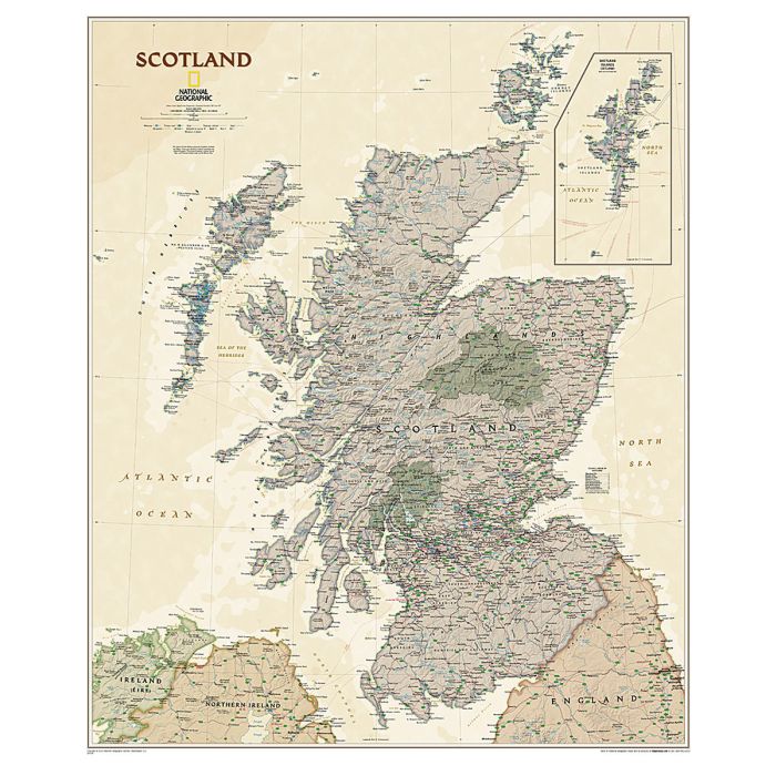
Scotland Executive Map Tubed
Reference Maps
£16.95
Temp Out Of Stock
| Cordee Code: | NG0729 |
|---|---|
| Page Size: | 750 x 900 mm |
| No of Pages: | 1 |
| Publisher: | National Geographic Wall Maps |
| ISBN13: | 9781597753630 |
| Binding: | Other |
| Weight: | 620g |
| Product Type: | Others |
| Countries: | Scotland |
Dimensions: H91cm x W76cm
A wall map of Scotland, paper version, from the National Geographic Society in their executive style designed to present current information in colouring reminiscent of antique maps with shades of beige and brown. The map presents Scotland on a base with relief shading to show the country's topography, with plenty of names of geographical features: mountain ranges, peaks, lochs and sounds of the coastal waters, etc. National Parks are highlighted. The map shows the division of Scotland into council areas. In addition to the road and rail networks, airports with scheduled services and ferry routes are marked. Also shown are oil pipelines and various historical sites.
A wall map of Scotland, paper version, from the National Geographic Society in their executive style designed to present current information in colouring reminiscent of antique maps with shades of beige and brown. The map presents Scotland on a base with relief shading to show the country's topography, with plenty of names of geographical features: mountain ranges, peaks, lochs and sounds of the coastal waters, etc. National Parks are highlighted. The map shows the division of Scotland into council areas. In addition to the road and rail networks, airports with scheduled services and ferry routes are marked. Also shown are oil pipelines and various historical sites.