We use cookies to make your experience better. To comply with the new e-Privacy directive, we need to ask for your consent to set the cookies. Learn more

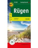
Rugen Island MecklenburgVorpommern, Roadmap 1:150000
Road and leisure map
£12.90
In Stock
Usually dispatched within 24 hrs. Free delivery to UK for orders £25 and over
| Cordee Code: | FB1747 |
|---|---|
| Page Size: | 130 x 255 mm |
| Publisher: | Freytag & Berndt |
| ISBN13: | 9783707920932 |
| Scale: | 1:150,000 |
| Published Date: | January 2026 |
| Edition: | 2026 |
| Binding: | Sheet Map (folded) |
| Illustrations: | Colour mapping |
| Weight: | 100g |
| Product Type: | Map |
| Countries: | Germany |
The Rugen - Mecklenburg-Vorpommern road map at a scale of 1:150,000 contains all the essential information for holidaymakers planning to visit Northern Germany by car, motorcycle, or caravan. The comprehensive road network is precisely depicted, tourist routes are colour-coded, and numerous tourist attractions are marked on the map.
Information on the road map of Rugen - Mecklenburg-Vorpommern
-Scale 1:150,000
-Tourist information
-Campsites
-Digital Ortsregister
Information on the road map of Rugen - Mecklenburg-Vorpommern
-Scale 1:150,000
-Tourist information
-Campsites
-Digital Ortsregister