We use cookies to make your experience better. To comply with the new e-Privacy directive, we need to ask for your consent to set the cookies. Learn more
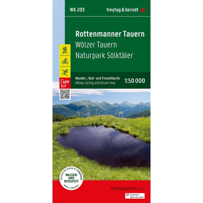
Rottenmanner Tauern
Hiking, Cycling and Leisure Map
£12.90
Temp Out Of Stock
The Rottenmanner Tauern hiking, cycling and leisure map offers detailed information about the hiking and cycling trails in the popular Styrian hiking region.
| Cordee Code: | FB1585 |
|---|---|
| Page Size: | 600 x 820 mm |
| No of Pages: | 1 |
| Publisher: | Freytag & Berndt |
| ISBN13: | 9783707920567 |
| Scale: | 1:50,000 |
| Author: | Freytag & Berndt |
| Published Date: | December 2023 |
| Edition: | 2023 |
| Binding: | Sheet Map (folded) |
| Illustrations: | colour mapping |
| Weight: | 86g |
| Product Type: | Map |
| Countries: | Austria |
The Rottenmanner Tauern hiking, cycling and leisure map offers detailed information about the hiking and cycling trails in the popular Styrian hiking region. The Wolzer Tauern and the Solktaler Nature Park are just a few of the many hiking highlights in the region.
With the hiking and cycling map you can ideally plan your tours and find out about the sights along the route.
Information about the Rottenmanner Tauern hiking and cycling map
Scale 1:50,000
Hiking trails
Tourist information
Roth app
Waterproof and tear-resistant
82 x 60 cm, double-sided
With the hiking and cycling map you can ideally plan your tours and find out about the sights along the route.
Information about the Rottenmanner Tauern hiking and cycling map
Scale 1:50,000
Hiking trails
Tourist information
Roth app
Waterproof and tear-resistant
82 x 60 cm, double-sided