We use cookies to make your experience better. To comply with the new e-Privacy directive, we need to ask for your consent to set the cookies. Learn more
Pryor Mountains Outdoor Recreation Map
£15.99
Temp Out Of Stock
| Cordee Code: | CMA600 |
|---|---|
| Publisher: | Cairn Cartographics |
| Published Date: | March 2023 |
| Edition: | 2023 |
| Binding: | Other |
| Product Type: | Map |
| Countries: | United States of America |
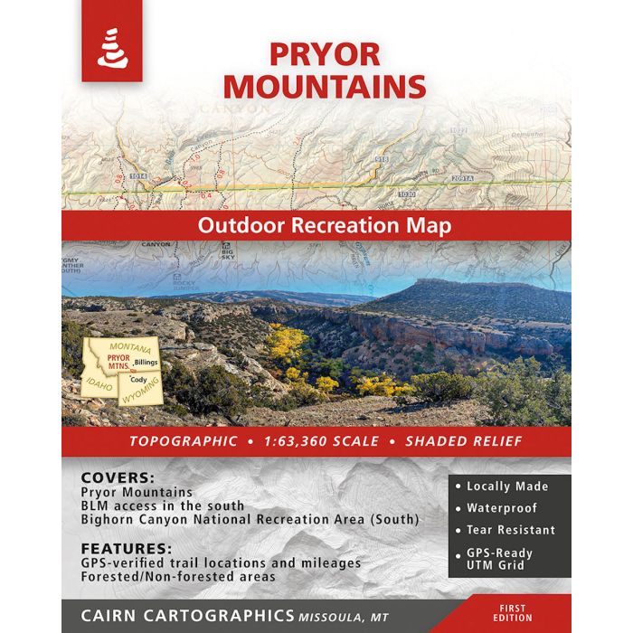
This map covers the Pryor Mountains south of Billings, MT on the Wyoming border. This diverse landscape has so much to explore and appreciate?from high sub-alpine meadows to Montana?s only red rock desert ecosystem, this range is not to be missed. During the summer and fall of 2023, we GPS?ed most of the trails on the map to make the trail locations and mileages as accurate as possible. This map was a collaboration with Wild Montana, who work to connect, unite, and mobilize for wild places in Montana. First Edition, printed in Spring 2023.
Covers:
-Pryor Mountain Range
-BLM access via Wyoming in the south
-Bighorn Canyon National Recreation Area (South)
Features:
-Topographic / Shaded Relief
-Forested and non-forested areas
-GPS verified trail locations and mileages
-1:63,360 Scale
-Contour interval: 100 feet
Covers:
-Pryor Mountain Range
-BLM access via Wyoming in the south
-Bighorn Canyon National Recreation Area (South)
Features:
-Topographic / Shaded Relief
-Forested and non-forested areas
-GPS verified trail locations and mileages
-1:63,360 Scale
-Contour interval: 100 feet