We use cookies to make your experience better. To comply with the new e-Privacy directive, we need to ask for your consent to set the cookies. Learn more
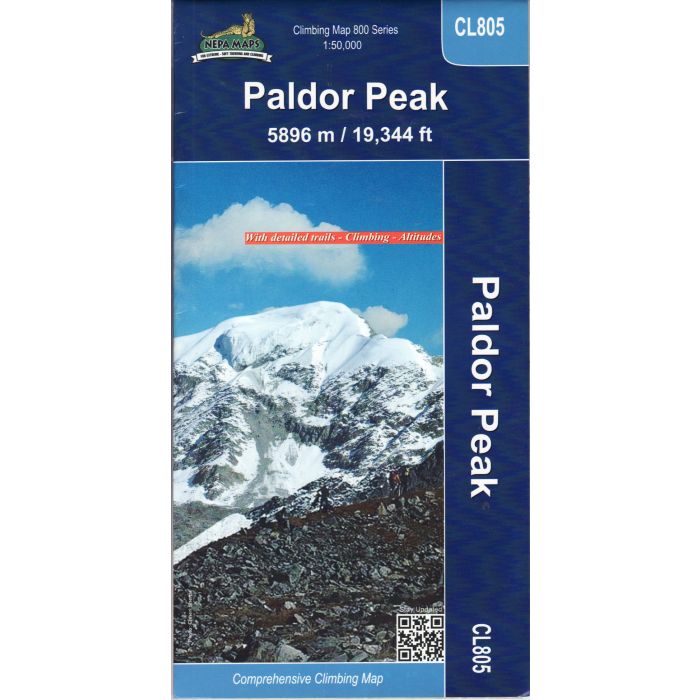
Paldor Bhrange Peak map
1:50,000
£16.99
Temp Out Of Stock
| Cordee Code: | CMW401 |
|---|---|
| Page Size: | 125 x 245 mm |
| Publisher: | Nepa Publications |
| ISBN13: | 9789993323037 |
| Author: | Nepa Maps |
| Language: | English |
| Published Date: | July 2014 |
| Edition: | 2014 |
| Binding: | Sheet Map (folded) |
| Weight: | 60g |
| Product Type: | Map |
| Countries: | Nepal |
Paldor Peak is one of the more popular among all trekking peaks in Nepal, situated at the south-east end of Ganesh Himal marking the connection of the Tiru and Karpu Dandas at the skull of the Mailung Khola, a branch of the Trisuli Gandaki river.
This map at 1:50,000 scale has been updated in 2014. Cartography is based on the country?s topographic survey, with contours usually at 40m or 50m intervals, enhanced by relief shading, colouring and graphics to show various features of the terrain, including glaciers, forested or cultivated areas, etc. Numerous peaks, with additional spot heights, plus names of glaciers and mountain ranges are prominently shown. The network of rivers, streams and lakes is shown in great detail, with many smaller rivers and lakes named.
This map at 1:50,000 scale has been updated in 2014. Cartography is based on the country?s topographic survey, with contours usually at 40m or 50m intervals, enhanced by relief shading, colouring and graphics to show various features of the terrain, including glaciers, forested or cultivated areas, etc. Numerous peaks, with additional spot heights, plus names of glaciers and mountain ranges are prominently shown. The network of rivers, streams and lakes is shown in great detail, with many smaller rivers and lakes named.


