We use cookies to make your experience better. To comply with the new e-Privacy directive, we need to ask for your consent to set the cookies. Read our privacy and security policy

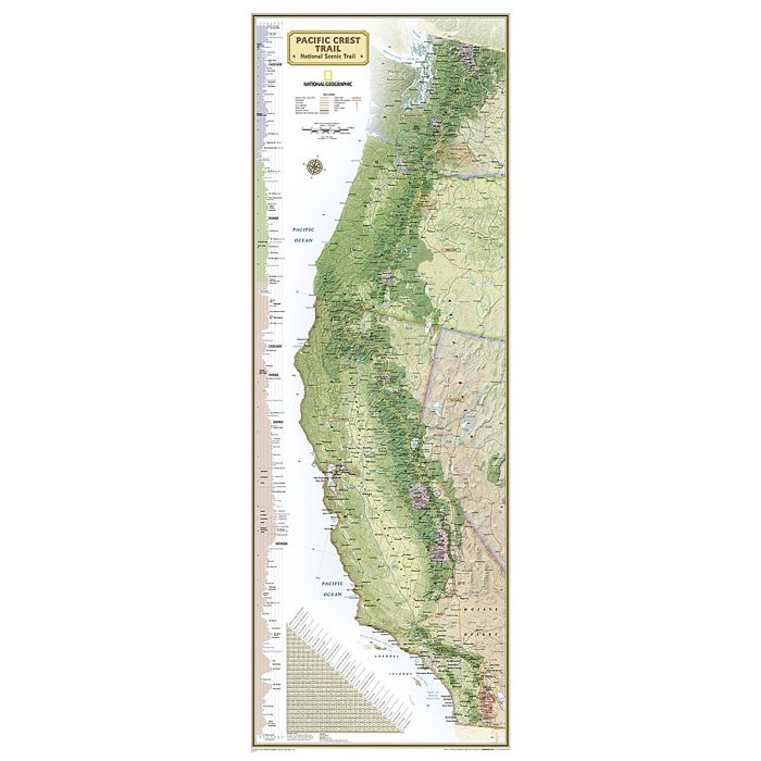
Pacific Crest Trail Map Laminated
Reference Maps
£29.95
In Stock
Usually dispatched within 24 hrs. Free delivery to UK for orders £25 and over
| Cordee Code: | NG0719 |
|---|---|
| Page Size: | 450 x 1200 mm |
| No of Pages: | 1 |
| Publisher: | National Geographic Maps |
| ISBN13: | 9781597755832 |
| Weight: | 350g |
| Product Type: | Others |
Dimensions: H122cm x W46cm
Expertly researched and designed, National Geographic's map of the Pacific Crest Trail is ideal for fans and hikers of this magnificent National Scenic Trail. It makes a great planning tool or as reference to track progress on the 2,600 plus mile length. This beautiful map shows the entire length of the trail from Mexico to Canada through California, Oregon, and Washington. A unique elevation profile highlights the trail's peaks and valleys, and an informative mileage chart shows the distance between key locations. Also highlighted on this map are passes, peaks, national forests, national parks, state parks, and Indian reservations. Additional points of interest include lodges and campgrounds near the trail.
The map is encapsulated in heavy-duty 1.6 mil laminate which makes the paper much more durable and resistant to the swelling and shrinking caused by changes in humidity. Laminated maps can be framed without the need for glass, so the frames can be much lighter and less expensive.
Expertly researched and designed, National Geographic's map of the Pacific Crest Trail is ideal for fans and hikers of this magnificent National Scenic Trail. It makes a great planning tool or as reference to track progress on the 2,600 plus mile length. This beautiful map shows the entire length of the trail from Mexico to Canada through California, Oregon, and Washington. A unique elevation profile highlights the trail's peaks and valleys, and an informative mileage chart shows the distance between key locations. Also highlighted on this map are passes, peaks, national forests, national parks, state parks, and Indian reservations. Additional points of interest include lodges and campgrounds near the trail.
The map is encapsulated in heavy-duty 1.6 mil laminate which makes the paper much more durable and resistant to the swelling and shrinking caused by changes in humidity. Laminated maps can be framed without the need for glass, so the frames can be much lighter and less expensive.