We use cookies to make your experience better. To comply with the new e-Privacy directive, we need to ask for your consent to set the cookies. Learn more
New River Blueway Map
Trails Illustrated Maps
£14.95
In Stock
Usually dispatched within 24 hrs. Free delivery to UK for orders £25 and over
| Cordee Code: | NG0541 |
|---|---|
| Publisher: | National Geographic Maps |
| ISBN13: | 9781566952637 |
| Binding: | Sheet Map (folded) |
| Weight: | 94g |
| Product Type: | Map |
| Countries: | United States of America |
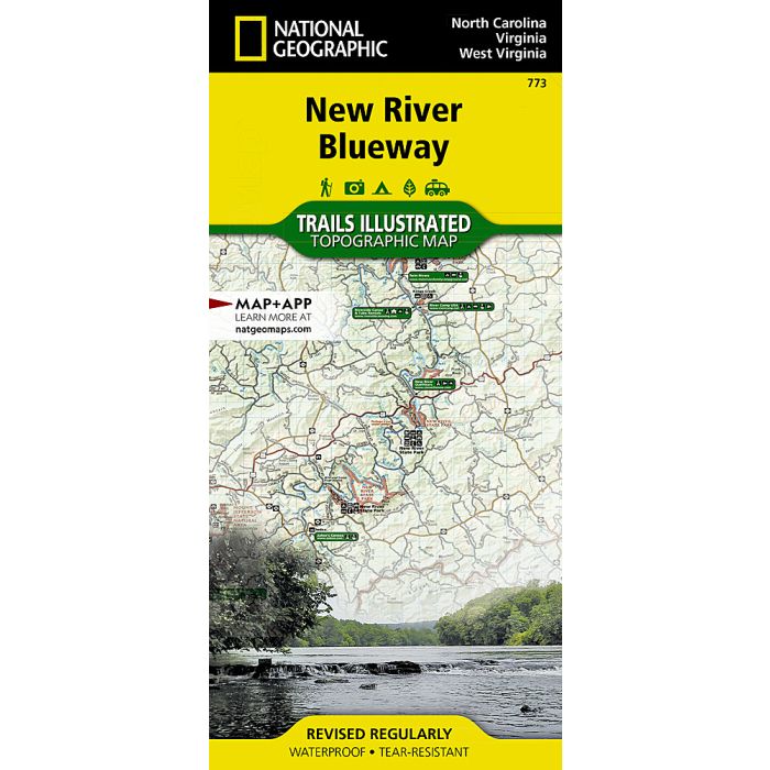
Waterproof Tear-Resistant Topographic MapThe New River flows north for over 250 miles from its origination in the Blue Ridge Mountains of North Carolina and snakes through the mountains, rolling hills, and farmland in Virginia, and then rolls on to the steep gorges of West Virginia's coal country. National Geographic's Trails Illustrated map of New River Blueway is designed to meet the needs of outdoor enthusiasts by combining valuable information with unmatched detail of this ancient river and surrounding areas. Created in partnership with local land management agencies, this expertly researched map highlights key areas of interest including Mount Jefferson State Natural Area; New River Trail State Park; Shot Tower Historic Park; and New River, Bluestone, and Claytor Lake state parks. A detailed inset of New River Gorge is provided in the print version of this map.Whether you're hiking portions of the Appalachian and New River trails, riding the Virginia Highlands Horse Trail, or traveling on the river itself, you'll find trails clearly marked to keep you on the right path. River mileage is noted and a river difficulty scale and safety tips will help keep you out of trouble. An informative summary of each park, as well as outfitter and agency contact information is included as well. Many recreation features are noted, including campgrounds, canoe access, boat launches, trailheads, rental cabins, and areas for skiing, swimming, and fishing. The map base includes contour lines, shaded relief, and elevations for summits.Every Trails Illustrated map is printed on "Backcountry Tough" waterproof, tear-resistant paper. A full UTM grid is printed on the map to aid with GPS navigation.Other features found on this map include: Blacksburg, Blue Ridge, Bluestone Lake, Boone, Claytor Lake, Clinch Mountain, East River, Flat Top Mountain, Greenbrier River, Iron Mountains, Jefferson National Forest, Lick Mountain, Mount Rogers, Mountain Lake Wilderness, New River Gorge, Peters Mountain, Sinking Creek, Stone Mountains.