We use cookies to make your experience better. To comply with the new e-Privacy directive, we need to ask for your consent to set the cookies. Learn more
Mt Everest Peakscapes Elevation Panorama
£19.99
In Stock
Usually dispatched within 24 hrs. Free delivery to UK for orders £25 and over
| Cordee Code: | CTO605 |
|---|---|
| Publisher: | Raven Maps |
| ISBN13: | 767020006220 |
| Binding: | Other |
| Weight: | 100g |
| Product Type: | Map |
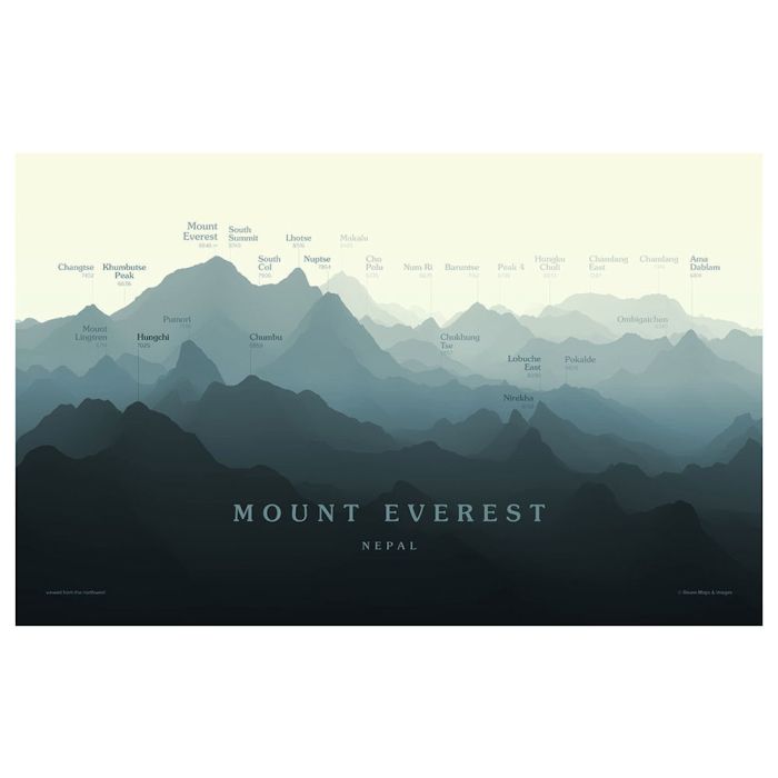
Known as "Sagarmatha" in Nepal and "Qomolangma" in Tibet, the world's highest summit straddles the border between China and Nepal in the heart of the Himalayas. Tales of the earliest attempts to climb the perennially ice-bound summit are the stuff of mountaineering legend, and scores of eager peakbaggers flock to the mountain each year hoping for a weather window that will give them a bid for the summit. Though elevated and set back from the mountain itself, view sees Everest from a common angle of approach, looking up the Western Cwm towards the South Col. An array of other high Himalayan summits are visible around Everest, including fellow 8,000-meter peaks Lhotse and Makalu.