We use cookies to make your experience better. To comply with the new e-Privacy directive, we need to ask for your consent to set the cookies. Learn more
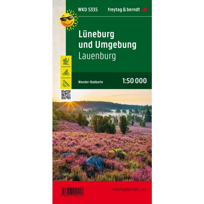
Luneburg and the surrounding area, Lauenburg
WKD5335 Walking Cycling & Leisure Map
£8.90
In Stock
Usually dispatched within 24 hrs. Free delivery to UK for orders £25 and over
| Cordee Code: | FB0914 |
|---|---|
| Page Size: | 100 x 205 mm |
| Publisher: | Freytag & Berndt |
| ISBN13: | 9783707920413 |
| Scale: | 1:50 000 |
| Published Date: | March 2022 |
| Binding: | Sheet Map (folded) |
| Weight: | 25g |
| Product Type: | Map |
| Countries: | Germany |
The hiking, cycling and leisure map of Luneburg and the surrounding area provides detailed information about the various hiking and cycling trails in Germany's most famous heathland. With the map you can ideally plan your tours through the nature park with the colorful heather and the Heidschnucke and find out about sights and vantage points along the way.
Descriptions of the routes, tips for excursions and stops in this flat and therefore cycling and hiking-friendly area can be found on the back.
Information on the hiking, cycling and leisure map of Luneburg and the surrounding area
Scale 1:50 000
hiking trails
bike lanes
bridle paths
Tourist information
GPX-Tracks zum Download
Waterproof and tear resistant
99 x 61 cm
Tourist information
Our new hiking, cycling and leisure map of Luneburg and the surrounding area shows the eastern foothills of the Luneburg Heath. The geest, forest and marsh areas are ideal for hiking, cycling and horseback riding. Especially for cyclists there are numerous easily passable paths that children can use safely. The villages in the region are ideal starting points for excursions into the heath and the historic salt and Hanseatic city of Luneburg is of course also worth a visit.
Waterproof and tear-resistant
The hiking map is printed on a special waterproof and durable paper so that it can also be used for orientation on rainy days.
Manufactured in a way that conserves resources
The map consists of 80% ground limestone. The production is much more resource-saving than with conventional paper because the consumption of water, wood and energy is significantly lower.