We use cookies to make your experience better. To comply with the new e-Privacy directive, we need to ask for your consent to set the cookies. Learn more
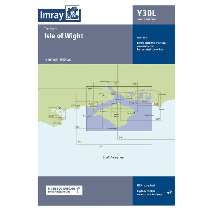
Laminated Y30 Isle of Wight Small Format
£23.95
Temp Out Of Stock
| Cordee Code: | IM0355 |
|---|---|
| Page Size: | 420 x 594 mm |
| No of Pages: | 2 |
| Publisher: | Fb Imray Laurie Norie And Wilson |
| ISBN13: | 9781786793614 |
| Binding: | Sheet Map (folded) |
| Weight: | 200g |
| Product Type: | Map |
A coastal chart of the Isle of Wight and the Solent with approaches from East and West.This edition includes the latest official UKHO data, combined with additional information sourced from Imray's network to make it ideal for small craft. It includes the latest official bathymetric surveys and racing buoy information. There has been general updating throughout. New: Vessel Traffic Services (VTS) reporting pointsImray charts for the Solent and approaches now include all VTS reporting points found in these waters. VTS reporting is mandatory for vessels of more than 20m in length that are bound to and from the Solent.Laminated.