We use cookies to make your experience better. To comply with the new e-Privacy directive, we need to ask for your consent to set the cookies. Learn more
Lake District High Level and Fell Walks
Walking in the Lake District - highest mountains in England
£12.95
In Stock
Usually dispatched within 24 hrs. Free delivery to UK for orders £25 and over
A guidebook to 30 higher-level day walks in the Lake District, exploring some of the best mountains, ridgewalks, fells and summits within the national park.
| Cordee Code: | CP0421 |
|---|---|
| Page Size: | 116 x 172 mm |
| No of Pages: | 208 |
| Publisher: | Cicerone Press |
| ISBN13: | 9781786312266 |
| Author: | Vivienne Crow |
| Published Date: | February 2024 |
| Edition: | 2nd Edition, Feb 2024 |
| Binding: | Paperback (flapped) |
| Illustrations: | Colour photos and mapping |
| Weight: | 230g |
| Geoarea: | Lake District |
| Product Type: | Guide Books |
| Countries: | United Kingdom |
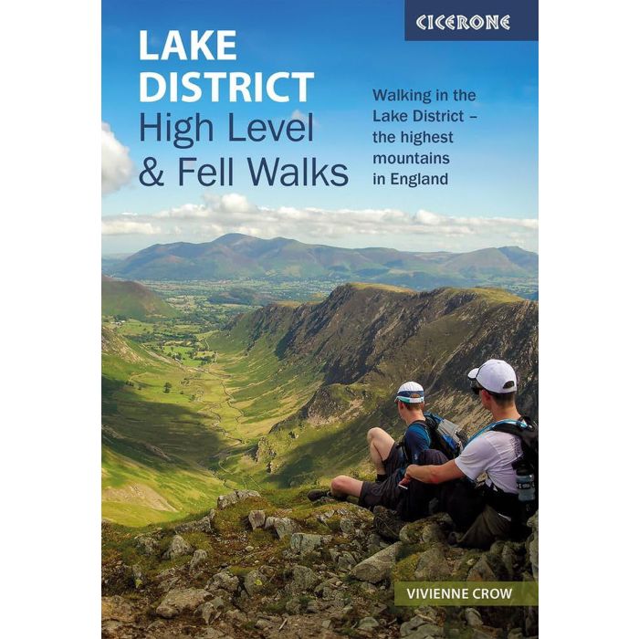
A guidebook to 30 higher-level day walks in the Lake District, exploring some of the best mountains, ridgewalks, fells and summits within the national park. Mostly circular except for a few linear routes that make use of public transport links, the walks are graded according to difficulty, ensuring there is something for all levels of fitness and experience.
The walks range from 7 to 24km (4?15 miles) in length and can be completed in between 3 and 9 hours. They are arranged geographically into 6 areas: Keswick, Borrowdale and Buttermere, the Western Valleys, Coniston and Langdale, Ambleside and Windermere, and Ullswater.
1:50,000 OS maps for each walk
GPX files available to download
Detailed information on terrain, refreshments and public transport for each walk
Information given on local history and archaeology
Highlights include Scafell Pike, Scafell, Helvellyn, Skiddaw, Newlands Round and the Fairfield Horseshoe
-
-
 The Danube CyclewayVolume 1 : From source in Black Forest to Budapest£14.95
CP0019
Temp Out Of StockOut of stock -
-