We use cookies to make your experience better. To comply with the new e-Privacy directive, we need to ask for your consent to set the cookies. Learn more
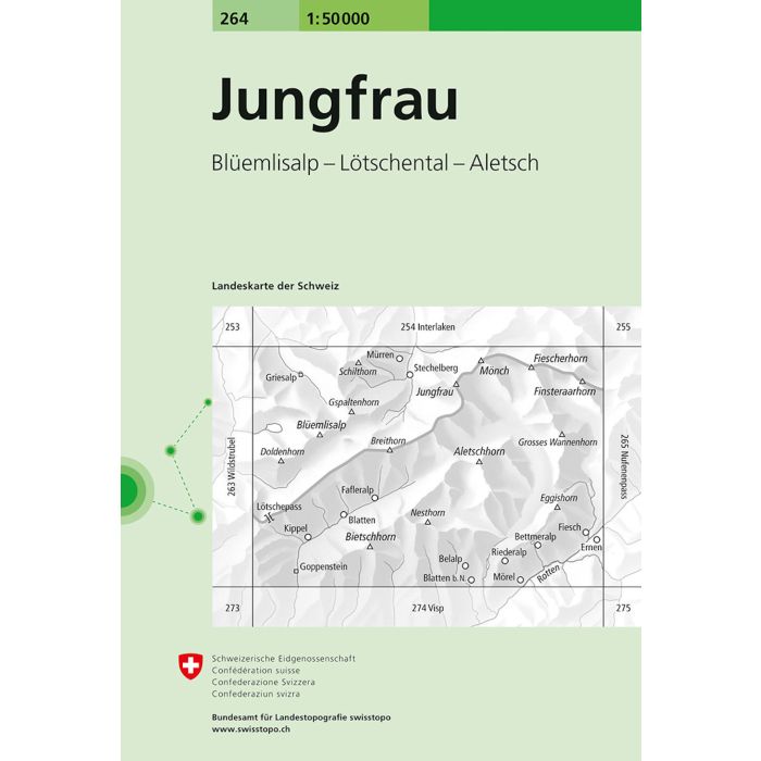
Jungfrau 264
1:50 000
£12.99
In Stock
Usually dispatched within 24 hrs. Free delivery to UK for orders £25 and over
Jungfrau, map No. 264, in the standard topographic survey of Switzerland at 1:50,000 from Swisstopo, i.e. without the special overprint highlighting walking trails, local bus stops, etc, presented in Swisstopo's hiking editions of the 50K survey.
| Cordee Code: | CMZ019 |
|---|---|
| Page Size: | 130 x 190 mm |
| Publisher: | Swisstopo |
| ISBN13: | 9783302002644 |
| Language: | English |
| Published Date: | March 2006 |
| Binding: | Sheet Map (folded) |
| Weight: | 40g |
| Product Type: | Map |
| Countries: | Switzerland |
Jungfrau, map No. 264, in the standard topographic survey of Switzerland at 1:50,000 from Swisstopo, i.e. without the special overprint highlighting walking trails, local bus stops, etc, presented in Swisstopo's hiking editions of the 50K survey. With the resort of M?rren at the top of the map, coverage includes the peaks of Monch and Jungfrau with the upper station of the Jungfraujoch Railway, and extends southwards to cover the whole of the Aletschgletscher, the larger glacier in the Alps.
Highly regarded for their superb use of graphic relief and hill shading, the maps give an almost 3-D picture of Switzerland's mountainous terrain. Contours are at 20m intervals. All the maps have a 1-km grid with the Swiss national coordinates.
Highly regarded for their superb use of graphic relief and hill shading, the maps give an almost 3-D picture of Switzerland's mountainous terrain. Contours are at 20m intervals. All the maps have a 1-km grid with the Swiss national coordinates.