We use cookies to make your experience better. To comply with the new e-Privacy directive, we need to ask for your consent to set the cookies. Learn more
Italy Classic Map Tubed
Reference Maps
£24.95
Temp Out Of Stock
| Cordee Code: | NG0685 |
|---|---|
| Page Size: | 580 x 860 mm |
| No of Pages: | 1 |
| Publisher: | National Geographic Maps |
| ISBN13: | 9780792249757 |
| Weight: | 620g |
| Product Type: | Others |
Dimensions: H87cm x W59cm
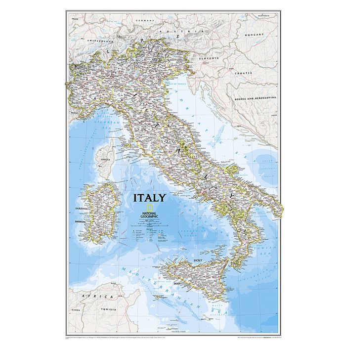
The Classic map of Italy is National Geographic's most detailed wall map of the enchanting and historically rich country. This attractive map features thousands of place names, accurate political boundaries, major infrastructure networks such as roads, canals, aqueducts, ferry routes, airports, and railroads. Italy's diverse terrain is detailed through accurate shaded relief, coastal bathymetry, and symbolism for water features and other land forms including the outlying islands of Corsica, Elba, Isola di Pantelleria, Isola San Domino, Isola di Ustica, Isole Eolle O Lipari, Sardinia and Sicily. Elevations of major peaks are expressed in feet and depth soundings are expressed in fathoms.
The signature Classic style map uses a bright, easy to read color palette featuring blue oceans and stunning shaded relief that has been featured on National Geographic wall maps for over 75 years.
The map is packaged in a two inch diameter tube with a label showing a thumbnail of the map with dimensions and other pertinent information.