We use cookies to make your experience better. To comply with the new e-Privacy directive, we need to ask for your consent to set the cookies. Read our privacy and security policy


Hiking the John Muir Trail
Through the Californian Sierra Nevada
£18.95
Not Yet Published
This title has not yet been released. You may pre-order now and we will deliver it to you when it arrives.
Contact [email protected]
Contact [email protected]
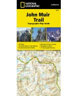
Guidebook to the John Muir Trail - one of North America's greatest long-distance hikes.
| Cordee Code: | CP0539 |
|---|---|
| Page Size: | 116 x 172 mm |
| No of Pages: | 208 |
| Publisher: | Cicerone Press |
| ISBN13: | 9781786313034 |
| Author: | David Jordan |
| Published Date: | January 2027 |
| Edition: | 2nd ed, Jan 2027 |
| Binding: | Paperback |
| Illustrations: | Colour photos & maps |
| Weight: | 250g |
| Product Type: | Guide Books |
| Countries: | United States of America |
Hiking the John Muir Trail is a complete stage-by-stage guide to one of the world's most celebrated long-distance hikes - a 340km (211-mile) traverse of California's High Sierra from Yosemite Valley to Mount Whitney, the highest peak in the contiguous United States.
The route is divided into 19 stages and can be hiked in either direction - southbound from Happy Isles in Yosemite Valley, or northbound from Whitney Portal or Horseshoe Meadow. It crosses iconic high mountain passes including Donohue, Muir, Mather and Forester, passing through some of North America's most spectacular alpine terrain: granite peaks, glacier-scoured basins, pristine lakes and wildflower meadows. Total ascent on the southbound route is around 14,530m (47,673ft). Detailed waypoint descriptions, elevation profiles and stage timing are provided for every stage in both directions, with comprehensive resupply information for Tuolumne Meadows, Red's Meadow/Mammoth Lakes, Vermilion Valley Resort, Muir Trail Ranch and Parchers Resort near Bishop Pass.
The JMT passes through Yosemite National Park, Ansel Adams Wilderness, John Muir Wilderness, Devils Postpile National Monument, Kings Canyon National Park and Sequoia National Park. Permits are required and must be booked through Recreation.gov; the guide covers all entry options in detail. Southbound hikers can start from Happy Isles or Lyell Canyon in Yosemite, while northbound hikers have three alternatives Whitney Portal, Cottonwood Pass or Cottonwood Lakes at Horseshoe Meadow - each with different quota systems, offering useful flexibility for securing a permit. The trail is best hiked July - September, with August the optimal month for snow-free passes and manageable river crossings. Reno-Tahoe International Airport offers the most direct access, with onward bus connections via Eastern Sierra Transit (ESTA) to trailheads at both ends of the route. Wild camping is the norm throughout.
-19 stages, 340km (211 miles) total, with full southbound and northbound route descriptions, elevation profiles and waypoint timing data
-Traverses iconic passes including Muir Pass, Mather Pass and Forester Pass, culminating at or starting from Mount Whitney (4,421m/14,505ft), the highest summit in the contiguous US
-Step-by-step permit guidance for Recreation.gov covering Yosemite National Park and Inyo National Forest trailheads, including lottery timelines and quota details
-Full resupply planning for Tuolumne Meadows, Red's Meadow/Mammoth Lakes, Vermilion Valley Resort, Muir Trail Ranch and Parchers Resort (near Bishop Pass), with mailing addresses and fees
-GPX files available to download; guide includes 1:100,000 maps with seasonal water source indicators
-Extensive planning section covering when to hike, permit applications, resupply strategies, training, equipment, water treatment, bear canisters and leave-no-trace principles - everything needed before setting foot on trail.