We use cookies to make your experience better. To comply with the new e-Privacy directive, we need to ask for your consent to set the cookies. Learn more
Haute Tinee 2 3640 ET
Isola 2000 Parc national du Mercantour
£15.80
In Stock
Usually dispatched within 24 hrs. Free delivery to UK for orders £25 and over
IGN Top 25 map series selected by IGN and cover the more popular areas of France.
| Cordee Code: | CMF759 |
|---|---|
| Page Size: | 110 x 240 mm |
| No of Pages: | 1 |
| Publisher: | Ign Top 25 Maps |
| ISBN13: | 9782758543343 |
| Published Date: | February 2019 |
| Edition: | 4th Ed, Feb 2019 |
| Binding: | Sheet Map (folded) |
| Weight: | 60g |
| Product Type: | Map |
| Countries: | France |
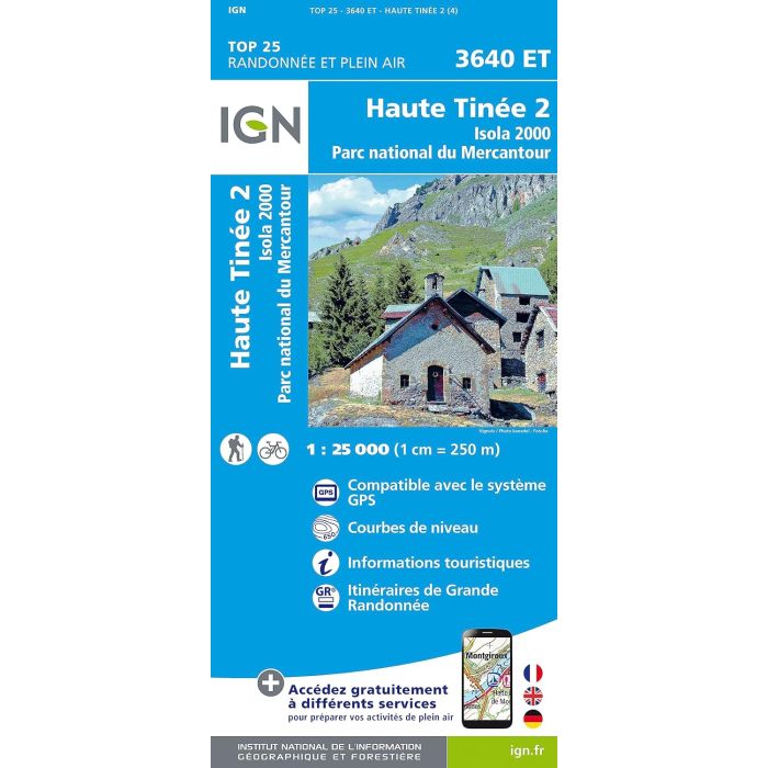
Map Scale: 1:25,000 (2.5 inches to the mile approx)
ET or OT = single-sided map
All maps are GPS compatible, with a 1km UTM grid plus latitude and longitude lines at 5 intervals.
Contours are at 5m intervals except for mountainous areas where the maps have contours at 10m intervals, vividly enhanced by hill shading and graphics for rocky terrain. Colouring with graphics indicates different types of vegetation or land use (deciduous or coniferous forests, moors, orchards, vineyards, etc).
Maps include an overprint highlighting waymarked walking trails including long-distance GR routes and, where appropriate, ski routes. Symbols indicate campsites, gites detape, refuges, equestrian centres and other recreational facilities or sites, tourist information centres, cultural heritage, etc. Towns and locations of particular interest are highlighted.
Map Legend includes English
Map coverage approx. 29 x 21 km / 18 x 13 miles.