We use cookies to make your experience better. To comply with the new e-Privacy directive, we need to ask for your consent to set the cookies. Learn more
Harjedalsfjallen 1:100K
£14.99
Refer To Cus Serv
Available by special order, contact [email protected] and we can advise expected delivery date.
| Cordee Code: | CMV379 |
|---|---|
| Page Size: | 130 x 210 mm |
| No of Pages: | 2 |
| Publisher: | Calazo Forlag Ab |
| ISBN13: | 9789189880030 |
| Binding: | Sheet Map (folded) |
| Product Type: | Others |
| Countries: | Sweden |
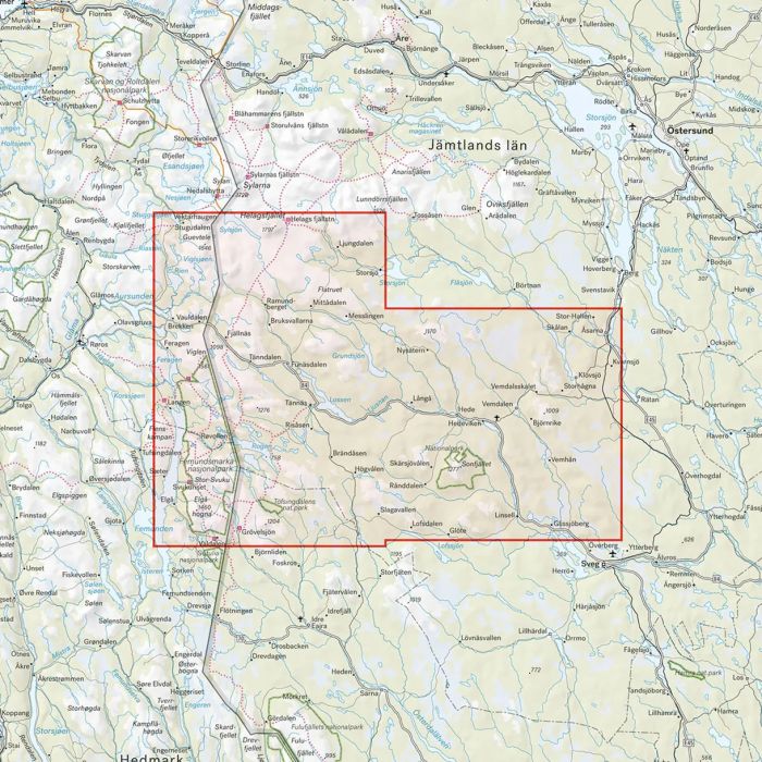
Calazo's ten map sheets on a scale of 1:100,000 cover the entire Swedish mountain world, from the Salen mountains to the Treriksroset. Each map sheet shows a large area, which provides a good overview when planning at home around the kitchen table - handy for those who are going on longer trips or getting over large areas with snowmobiles. For obvious reasons, the content is more generalized than in more detailed mountain maps on a scale of 1:50,000 or high mountain maps on a scale of 1:25,000. This map covers the Harjedal mountains from Helags in the north to Grovelsjon in the south. The map covers the Rogen Nature Reserve, the national parks Tofsingdalen and Sonfjallet as well as Femundsmarka National Park in Norway.The map is printed on Tyvek, a material that is completely insensitive to water and incredibly tear-resistant.