We use cookies to make your experience better. To comply with the new e-Privacy directive, we need to ask for your consent to set the cookies. Learn more
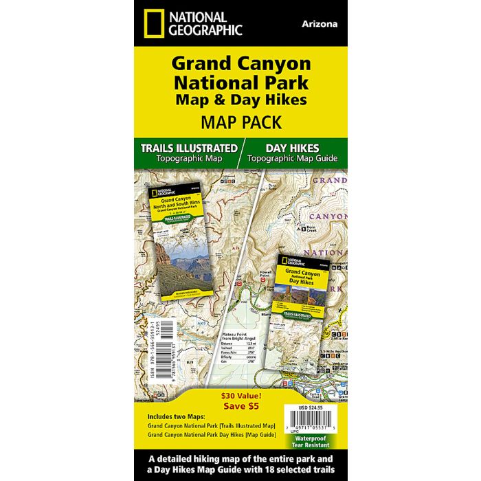
Grand Canyon National Park Map and Day Hikes
Map Pack
£24.95
In Stock
Usually dispatched within 24 hrs. Free delivery to UK for orders £25 and over
| Cordee Code: | NG0864 |
|---|---|
| Page Size: | 110 x 230 mm |
| Publisher: | National Geographic Maps |
| ISBN13: | 9781566959131 |
| Published Date: | April 2024 |
| Edition: | 1st ed, April 2024 |
| Binding: | Map And Guide |
| Weight: | 200g |
| Product Type: | Map |
| Countries: | United States of America |
Waterproof Tear-Resistant Topographic Maps.
Grand Canyon is one of the most spectacular examples of erosion anywhere in the world—unmatched in the incomparable vistas it offers visitors from the rim. This two title Map Pack Bundle helps explorers of all levels see everything this astounding park has to offer. The map pack includes an overview map that shows the most visited sections of the North and South Rims as well as a Day Hikes map guide. With this combination of maps visitors can feel comfortable planning a trip to a park with options for everyone, from multi-day backpack trips to the 3.0 mile North Rim Lookout Tower Trail.
The Grand Canyon National Park Day Hikes Topographic Map Guide includes seventeen diverse hikes for all hiking enthusiasts, the hikes range in difficulty and distance to help hikers select the best trail for their timing, abilities, and location within the parks. Each hike has a detailed map, a trail profile visualizing the changes in elevation, and a short summary of the interesting features encountered along the trip.
The Grand Canyon Day Hikes and National Park Map Pack includes:
- Map 261 :: Grand Canyon, North and South Rims
- Map 1711 :: Grand Canyon Day Hikes
Every Trails Illustrated map is printed on "Backcountry Tough" waterproof, tear-resistant paper. A full UTM grid is printed on the map to aid with GPS navigation.